You are here: Home > Network List > IW - Intermountain West Stations List
> Station MOOW Moose Ponds, Wyoming, USA > Earthquake Result Viewer
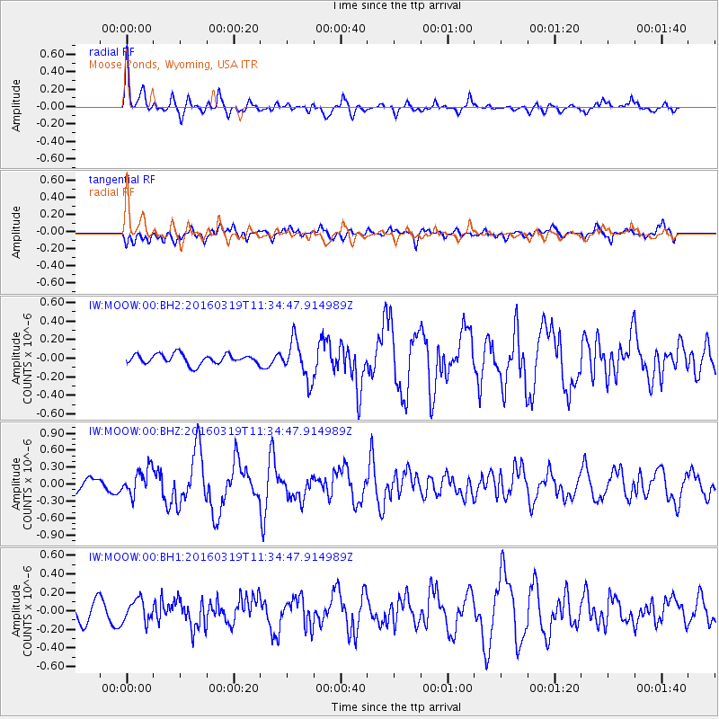
MOOW Moose Ponds, Wyoming, USA - Earthquake Result Viewer
*The percent match for this event was below the threshold and hence no stack was calculated.
| Earthquake location: |
Leeward Islands |
| Earthquake latitude/longitude: |
18.0/-60.7 |
| Earthquake time(UTC): |
2016/03/19 (079) 11:26:34 GMT |
| Earthquake Depth: |
32 km |
| Earthquake Magnitude: |
6.0 MWW, 5.9 MWB |
| Earthquake Catalog/Contributor: |
NEIC PDE/NEIC COMCAT |
|
| Network: |
IW Intermountain West |
| Station: |
MOOW Moose Ponds, Wyoming, USA |
| Lat/Lon: |
43.75 N/110.74 W |
| Elevation: |
2128 m |
|
| Distance: |
49.1 deg |
| Az: |
312.717 deg |
| Baz: |
105.233 deg |
| Ray Param: |
$rayparam |
*The percent match for this event was below the threshold and hence was not used in the summary stack. |
|
| Radial Match: |
74.17463 % |
| Radial Bump: |
400 |
| Transverse Match: |
64.37856 % |
| Transverse Bump: |
400 |
| SOD ConfigId: |
1464191 |
| Insert Time: |
2016-04-02 12:05:03.149 +0000 |
| GWidth: |
2.5 |
| Max Bumps: |
400 |
| Tol: |
0.001 |
|
Signal To Noise
| Channel | StoN | STA | LTA |
| IW:MOOW:00:BHZ:20160319T11:34:47.914989Z | 1.6868485 | 2.360683E-7 | 1.3994635E-7 |
| IW:MOOW:00:BH1:20160319T11:34:47.914989Z | 1.032568 | 1.194139E-7 | 1.156475E-7 |
| IW:MOOW:00:BH2:20160319T11:34:47.914989Z | 3.9189792 | 2.0968783E-7 | 5.3505726E-8 |
| Arrivals |
| Ps | |
| PpPs | |
| PsPs/PpSs | |


