You are here: Home > Network List > CI - Caltech Regional Seismic Network Stations List
> Station SMM Simmler, CA, USA > Earthquake Result Viewer
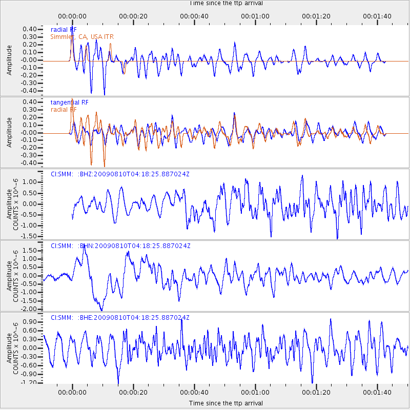
SMM Simmler, CA, USA - Earthquake Result Viewer
*The percent match for this event was below the threshold and hence no stack was calculated.
| Earthquake location: |
Santa Cruz Islands |
| Earthquake latitude/longitude: |
-11.6/166.1 |
| Earthquake time(UTC): |
2009/08/10 (222) 04:06:31 GMT |
| Earthquake Depth: |
35 km |
| Earthquake Magnitude: |
5.8 MB, 6.3 MS, 6.6 MW, 6.6 MW |
| Earthquake Catalog/Contributor: |
WHDF/NEIC |
|
| Network: |
CI Caltech Regional Seismic Network |
| Station: |
SMM Simmler, CA, USA |
| Lat/Lon: |
35.31 N/120.00 W |
| Elevation: |
599 m |
|
| Distance: |
83.9 deg |
| Az: |
52.217 deg |
| Baz: |
251.239 deg |
| Ray Param: |
$rayparam |
*The percent match for this event was below the threshold and hence was not used in the summary stack. |
|
| Radial Match: |
73.0036 % |
| Radial Bump: |
400 |
| Transverse Match: |
52.0966 % |
| Transverse Bump: |
400 |
| SOD ConfigId: |
2622 |
| Insert Time: |
2010-02-26 01:32:36.034 +0000 |
| GWidth: |
2.5 |
| Max Bumps: |
400 |
| Tol: |
0.001 |
|
Signal To Noise
| Channel | StoN | STA | LTA |
| CI:SMM: :BHN:20090810T04:18:25.887024Z | 7.9839616 | 1.0041781E-6 | 1.2577442E-7 |
| CI:SMM: :BHE:20090810T04:18:25.887024Z | 1.5767977 | 3.6711938E-7 | 2.3282594E-7 |
| CI:SMM: :BHZ:20090810T04:18:25.887024Z | 1.1397253 | 3.9577878E-7 | 3.4725804E-7 |
| Arrivals |
| Ps | |
| PpPs | |
| PsPs/PpSs | |


