You are here: Home > Network List > TA - USArray Transportable Network (new EarthScope stations) Stations List
> Station K29M Barlow Dome, YT, CAN > Earthquake Result Viewer
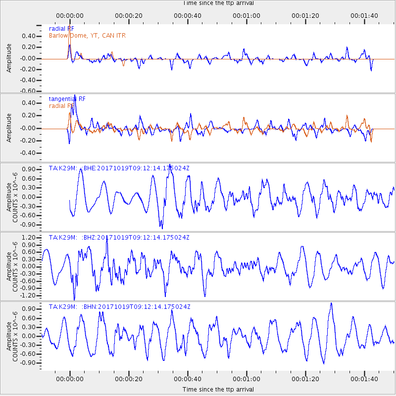
K29M Barlow Dome, YT, CAN - Earthquake Result Viewer
*The percent match for this event was below the threshold and hence no stack was calculated.
| Earthquake location: |
Southeast Of Ryukyu Islands |
| Earthquake latitude/longitude: |
28.3/131.2 |
| Earthquake time(UTC): |
2017/10/19 (292) 09:02:01 GMT |
| Earthquake Depth: |
10 km |
| Earthquake Magnitude: |
5.8 Mww |
| Earthquake Catalog/Contributor: |
NEIC PDE/us |
|
| Network: |
TA USArray Transportable Network (new EarthScope stations) |
| Station: |
K29M Barlow Dome, YT, CAN |
| Lat/Lon: |
63.84 N/137.52 W |
| Elevation: |
1367 m |
|
| Distance: |
65.5 deg |
| Az: |
29.135 deg |
| Baz: |
284.43 deg |
| Ray Param: |
$rayparam |
*The percent match for this event was below the threshold and hence was not used in the summary stack. |
|
| Radial Match: |
60.401543 % |
| Radial Bump: |
326 |
| Transverse Match: |
78.23199 % |
| Transverse Bump: |
400 |
| SOD ConfigId: |
13570011 |
| Insert Time: |
2019-04-29 00:17:52.730 +0000 |
| GWidth: |
2.5 |
| Max Bumps: |
400 |
| Tol: |
0.001 |
|
Signal To Noise
| Channel | StoN | STA | LTA |
| TA:K29M: :BHZ:20171019T09:12:14.175024Z | 1.2533308 | 6.08008E-7 | 4.8511373E-7 |
| TA:K29M: :BHN:20171019T09:12:14.175024Z | 0.9460788 | 4.5894666E-7 | 4.8510407E-7 |
| TA:K29M: :BHE:20171019T09:12:14.175024Z | 1.9268075 | 6.7054515E-7 | 3.480084E-7 |
| Arrivals |
| Ps | |
| PpPs | |
| PsPs/PpSs | |


