You are here: Home > Network List > TA - USArray Transportable Network (new EarthScope stations) Stations List
> Station N25K Chitina, Valdez-Cordova, AK, USA > Earthquake Result Viewer
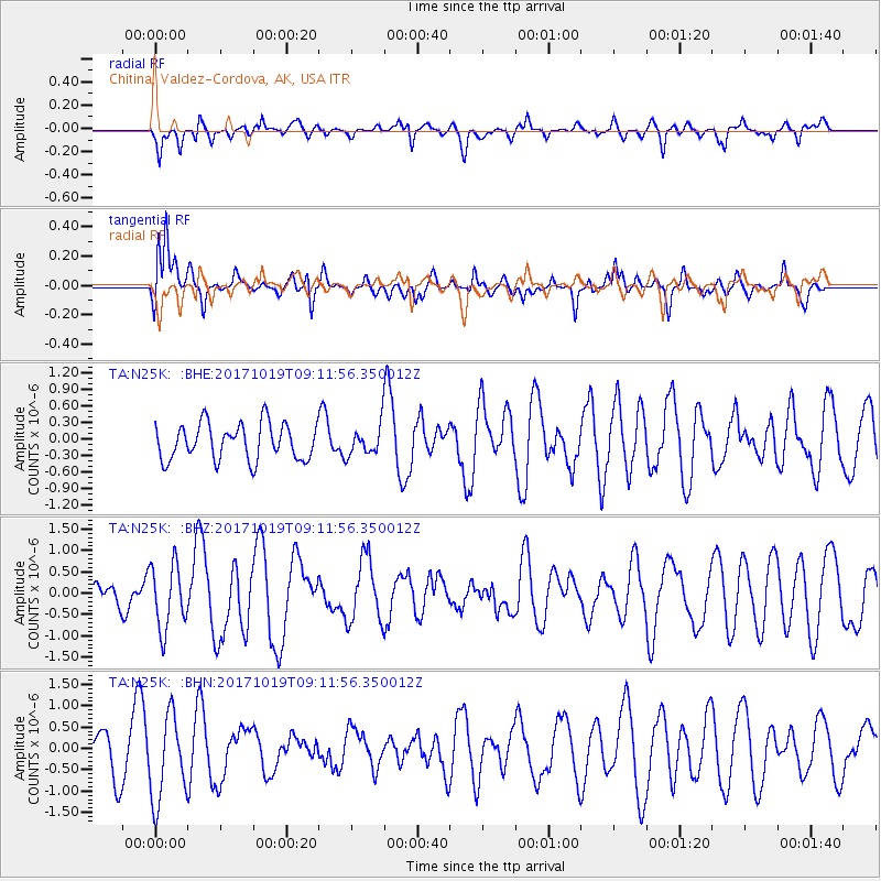
N25K Chitina, Valdez-Cordova, AK, USA - Earthquake Result Viewer
*The percent match for this event was below the threshold and hence no stack was calculated.
| Earthquake location: |
Southeast Of Ryukyu Islands |
| Earthquake latitude/longitude: |
28.3/131.2 |
| Earthquake time(UTC): |
2017/10/19 (292) 09:02:01 GMT |
| Earthquake Depth: |
10 km |
| Earthquake Magnitude: |
5.8 Mww |
| Earthquake Catalog/Contributor: |
NEIC PDE/us |
|
| Network: |
TA USArray Transportable Network (new EarthScope stations) |
| Station: |
N25K Chitina, Valdez-Cordova, AK, USA |
| Lat/Lon: |
61.61 N/144.60 W |
| Elevation: |
1087 m |
|
| Distance: |
62.8 deg |
| Az: |
32.323 deg |
| Baz: |
279.535 deg |
| Ray Param: |
$rayparam |
*The percent match for this event was below the threshold and hence was not used in the summary stack. |
|
| Radial Match: |
60.014587 % |
| Radial Bump: |
400 |
| Transverse Match: |
60.74396 % |
| Transverse Bump: |
400 |
| SOD ConfigId: |
13570011 |
| Insert Time: |
2019-04-29 00:18:01.598 +0000 |
| GWidth: |
2.5 |
| Max Bumps: |
400 |
| Tol: |
0.001 |
|
Signal To Noise
| Channel | StoN | STA | LTA |
| TA:N25K: :BHZ:20171019T09:11:56.350012Z | 1.1998713 | 7.556992E-7 | 6.298169E-7 |
| TA:N25K: :BHN:20171019T09:11:56.350012Z | 2.1651065 | 1.0051882E-6 | 4.6426734E-7 |
| TA:N25K: :BHE:20171019T09:11:56.350012Z | 0.82386357 | 2.714708E-7 | 3.2950942E-7 |
| Arrivals |
| Ps | |
| PpPs | |
| PsPs/PpSs | |


