You are here: Home > Network List > TJ - Tajikistan National Seismic Network Stations List
> Station GARM Garm, Tajikistan > Earthquake Result Viewer
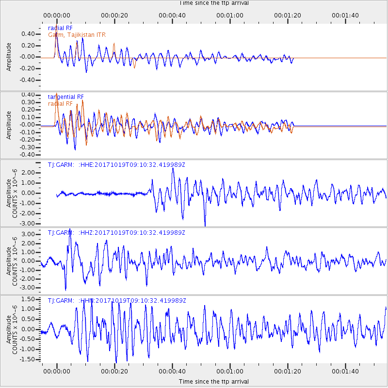
GARM Garm, Tajikistan - Earthquake Result Viewer
*The percent match for this event was below the threshold and hence no stack was calculated.
| Earthquake location: |
Southeast Of Ryukyu Islands |
| Earthquake latitude/longitude: |
28.3/131.2 |
| Earthquake time(UTC): |
2017/10/19 (292) 09:02:01 GMT |
| Earthquake Depth: |
10 km |
| Earthquake Magnitude: |
5.8 Mww |
| Earthquake Catalog/Contributor: |
NEIC PDE/us |
|
| Network: |
TJ Tajikistan National Seismic Network |
| Station: |
GARM Garm, Tajikistan |
| Lat/Lon: |
39.00 N/70.32 E |
| Elevation: |
1305 m |
|
| Distance: |
50.9 deg |
| Az: |
298.762 deg |
| Baz: |
82.685 deg |
| Ray Param: |
$rayparam |
*The percent match for this event was below the threshold and hence was not used in the summary stack. |
|
| Radial Match: |
75.452774 % |
| Radial Bump: |
400 |
| Transverse Match: |
76.27734 % |
| Transverse Bump: |
400 |
| SOD ConfigId: |
13570011 |
| Insert Time: |
2019-04-29 00:18:18.110 +0000 |
| GWidth: |
2.5 |
| Max Bumps: |
400 |
| Tol: |
0.001 |
|
Signal To Noise
| Channel | StoN | STA | LTA |
| TJ:GARM: :HHZ:20171019T09:10:32.419989Z | 9.045426 | 1.4254111E-6 | 1.5758363E-7 |
| TJ:GARM: :HHN:20171019T09:10:32.419989Z | 2.284842 | 1.9806527E-7 | 8.668663E-8 |
| TJ:GARM: :HHE:20171019T09:10:32.419989Z | 7.762323 | 6.637552E-7 | 8.550987E-8 |
| Arrivals |
| Ps | |
| PpPs | |
| PsPs/PpSs | |


