You are here: Home > Network List > AK - Alaska Regional Network Stations List
> Station MDM Murphy Dome > Earthquake Result Viewer
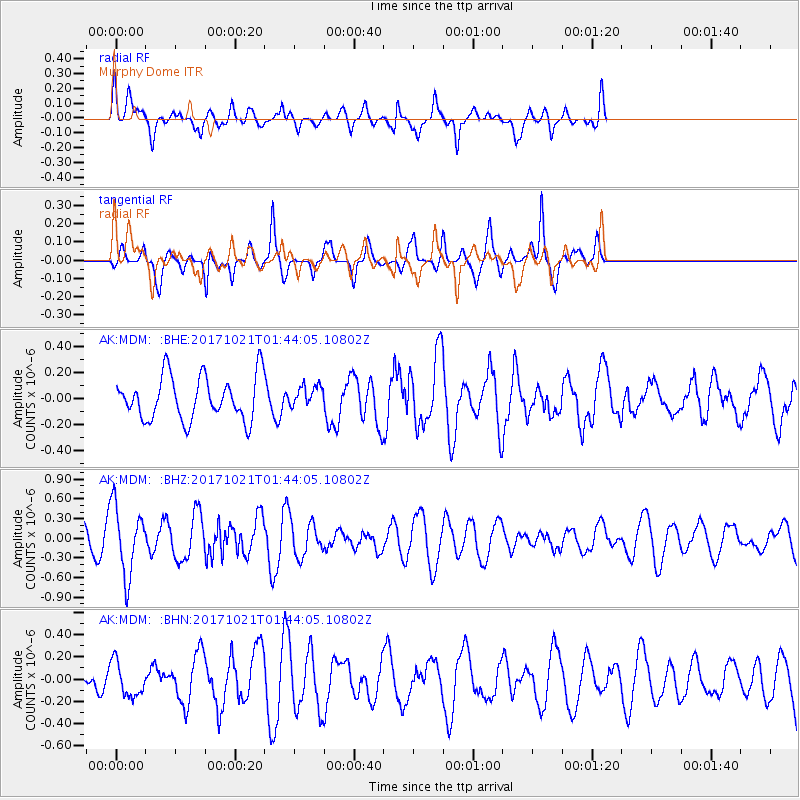
MDM Murphy Dome - Earthquake Result Viewer
*The percent match for this event was below the threshold and hence no stack was calculated.
| Earthquake location: |
Talaud Islands, Indonesia |
| Earthquake latitude/longitude: |
4.1/127.9 |
| Earthquake time(UTC): |
2017/10/21 (294) 01:32:14 GMT |
| Earthquake Depth: |
62 km |
| Earthquake Magnitude: |
5.3 Mww |
| Earthquake Catalog/Contributor: |
NEIC PDE/us |
|
| Network: |
AK Alaska Regional Network |
| Station: |
MDM Murphy Dome |
| Lat/Lon: |
64.96 N/148.23 W |
| Elevation: |
634 m |
|
| Distance: |
83.7 deg |
| Az: |
25.199 deg |
| Baz: |
266.223 deg |
| Ray Param: |
$rayparam |
*The percent match for this event was below the threshold and hence was not used in the summary stack. |
|
| Radial Match: |
54.01189 % |
| Radial Bump: |
400 |
| Transverse Match: |
75.21313 % |
| Transverse Bump: |
343 |
| SOD ConfigId: |
13570011 |
| Insert Time: |
2019-04-29 00:19:46.221 +0000 |
| GWidth: |
2.5 |
| Max Bumps: |
400 |
| Tol: |
0.001 |
|
Signal To Noise
| Channel | StoN | STA | LTA |
| AK:MDM: :BHZ:20171021T01:44:05.10802Z | 1.8686407 | 5.201558E-7 | 2.7836052E-7 |
| AK:MDM: :BHN:20171021T01:44:05.10802Z | 0.83097297 | 1.5298185E-7 | 1.8409968E-7 |
| AK:MDM: :BHE:20171021T01:44:05.10802Z | 0.4890376 | 8.1836795E-8 | 1.6734255E-7 |
| Arrivals |
| Ps | |
| PpPs | |
| PsPs/PpSs | |


