You are here: Home > Network List > US - United States National Seismic Network Stations List
> Station BOZ Bozeman, Montana, USA > Earthquake Result Viewer
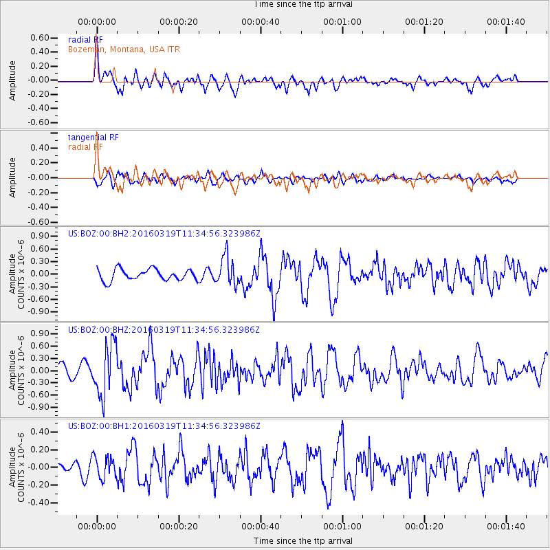
BOZ Bozeman, Montana, USA - Earthquake Result Viewer
*The percent match for this event was below the threshold and hence no stack was calculated.
| Earthquake location: |
Leeward Islands |
| Earthquake latitude/longitude: |
18.0/-60.7 |
| Earthquake time(UTC): |
2016/03/19 (079) 11:26:34 GMT |
| Earthquake Depth: |
32 km |
| Earthquake Magnitude: |
6.0 MWW, 5.9 MWB |
| Earthquake Catalog/Contributor: |
NEIC PDE/NEIC COMCAT |
|
| Network: |
US United States National Seismic Network |
| Station: |
BOZ Bozeman, Montana, USA |
| Lat/Lon: |
45.65 N/111.63 W |
| Elevation: |
1589 m |
|
| Distance: |
50.2 deg |
| Az: |
314.892 deg |
| Baz: |
106.02 deg |
| Ray Param: |
$rayparam |
*The percent match for this event was below the threshold and hence was not used in the summary stack. |
|
| Radial Match: |
75.287575 % |
| Radial Bump: |
400 |
| Transverse Match: |
49.10163 % |
| Transverse Bump: |
400 |
| SOD ConfigId: |
1464191 |
| Insert Time: |
2016-04-02 12:07:14.825 +0000 |
| GWidth: |
2.5 |
| Max Bumps: |
400 |
| Tol: |
0.001 |
|
Signal To Noise
| Channel | StoN | STA | LTA |
| US:BOZ:00:BHZ:20160319T11:34:56.323986Z | 3.729491 | 6.540854E-7 | 1.7538196E-7 |
| US:BOZ:00:BH1:20160319T11:34:56.323986Z | 1.5024854 | 1.2038065E-7 | 8.0121005E-8 |
| US:BOZ:00:BH2:20160319T11:34:56.323986Z | 2.618613 | 3.5145695E-7 | 1.3421493E-7 |
| Arrivals |
| Ps | |
| PpPs | |
| PsPs/PpSs | |


