You are here: Home > Network List > TA - USArray Transportable Network (new EarthScope stations) Stations List
> Station F20K Avaraart Lake, AK, USA > Earthquake Result Viewer
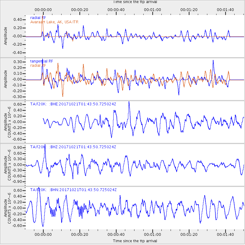
F20K Avaraart Lake, AK, USA - Earthquake Result Viewer
*The percent match for this event was below the threshold and hence no stack was calculated.
| Earthquake location: |
Talaud Islands, Indonesia |
| Earthquake latitude/longitude: |
4.1/127.9 |
| Earthquake time(UTC): |
2017/10/21 (294) 01:32:14 GMT |
| Earthquake Depth: |
62 km |
| Earthquake Magnitude: |
5.3 Mww |
| Earthquake Catalog/Contributor: |
NEIC PDE/us |
|
| Network: |
TA USArray Transportable Network (new EarthScope stations) |
| Station: |
F20K Avaraart Lake, AK, USA |
| Lat/Lon: |
67.05 N/155.73 W |
| Elevation: |
136 m |
|
| Distance: |
80.9 deg |
| Az: |
22.707 deg |
| Baz: |
259.047 deg |
| Ray Param: |
$rayparam |
*The percent match for this event was below the threshold and hence was not used in the summary stack. |
|
| Radial Match: |
59.658875 % |
| Radial Bump: |
400 |
| Transverse Match: |
43.066048 % |
| Transverse Bump: |
400 |
| SOD ConfigId: |
13570011 |
| Insert Time: |
2019-04-29 00:21:58.943 +0000 |
| GWidth: |
2.5 |
| Max Bumps: |
400 |
| Tol: |
0.001 |
|
Signal To Noise
| Channel | StoN | STA | LTA |
| TA:F20K: :BHZ:20171021T01:43:50.725024Z | 4.011148 | 3.9632565E-7 | 9.8806034E-8 |
| TA:F20K: :BHN:20171021T01:43:50.725024Z | 1.831641 | 3.1128863E-7 | 1.6995068E-7 |
| TA:F20K: :BHE:20171021T01:43:50.725024Z | 0.79222494 | 1.0635662E-7 | 1.3425054E-7 |
| Arrivals |
| Ps | |
| PpPs | |
| PsPs/PpSs | |


