You are here: Home > Network List > TA - USArray Transportable Network (new EarthScope stations) Stations List
> Station G22K Bettles, AK, USA > Earthquake Result Viewer
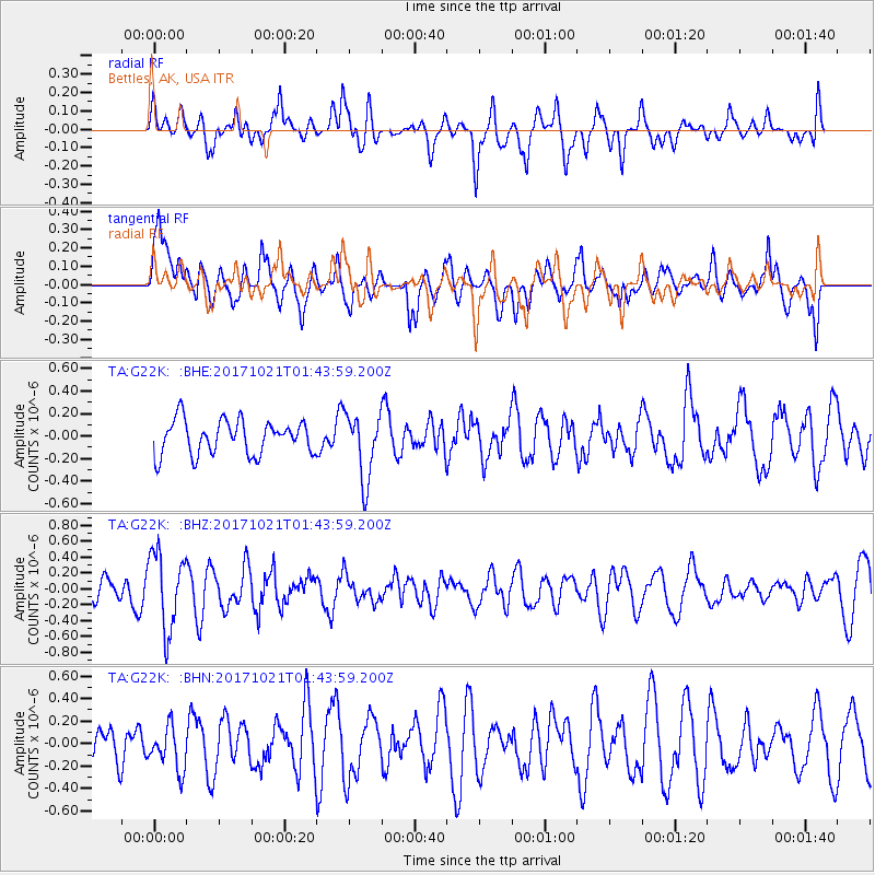
G22K Bettles, AK, USA - Earthquake Result Viewer
*The percent match for this event was below the threshold and hence no stack was calculated.
| Earthquake location: |
Talaud Islands, Indonesia |
| Earthquake latitude/longitude: |
4.1/127.9 |
| Earthquake time(UTC): |
2017/10/21 (294) 01:32:14 GMT |
| Earthquake Depth: |
62 km |
| Earthquake Magnitude: |
5.3 Mww |
| Earthquake Catalog/Contributor: |
NEIC PDE/us |
|
| Network: |
TA USArray Transportable Network (new EarthScope stations) |
| Station: |
G22K Bettles, AK, USA |
| Lat/Lon: |
66.92 N/151.51 W |
| Elevation: |
205 m |
|
| Distance: |
82.5 deg |
| Az: |
23.096 deg |
| Baz: |
262.981 deg |
| Ray Param: |
$rayparam |
*The percent match for this event was below the threshold and hence was not used in the summary stack. |
|
| Radial Match: |
64.584045 % |
| Radial Bump: |
400 |
| Transverse Match: |
61.50982 % |
| Transverse Bump: |
400 |
| SOD ConfigId: |
13570011 |
| Insert Time: |
2019-04-29 00:22:03.608 +0000 |
| GWidth: |
2.5 |
| Max Bumps: |
400 |
| Tol: |
0.001 |
|
Signal To Noise
| Channel | StoN | STA | LTA |
| TA:G22K: :BHZ:20171021T01:43:59.200Z | 3.1636891 | 4.8183506E-7 | 1.5230164E-7 |
| TA:G22K: :BHN:20171021T01:43:59.200Z | 0.9933515 | 1.900593E-7 | 1.9133135E-7 |
| TA:G22K: :BHE:20171021T01:43:59.200Z | 1.9619447 | 2.9444143E-7 | 1.500763E-7 |
| Arrivals |
| Ps | |
| PpPs | |
| PsPs/PpSs | |


