You are here: Home > Network List > US - United States National Seismic Network Stations List
> Station EGMT Eagleton, Montana, USA > Earthquake Result Viewer
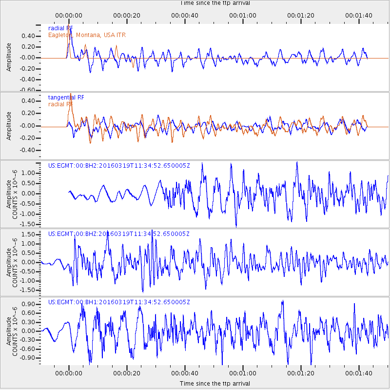
EGMT Eagleton, Montana, USA - Earthquake Result Viewer
*The percent match for this event was below the threshold and hence no stack was calculated.
| Earthquake location: |
Leeward Islands |
| Earthquake latitude/longitude: |
18.0/-60.7 |
| Earthquake time(UTC): |
2016/03/19 (079) 11:26:34 GMT |
| Earthquake Depth: |
32 km |
| Earthquake Magnitude: |
6.0 MWW, 5.9 MWB |
| Earthquake Catalog/Contributor: |
NEIC PDE/NEIC COMCAT |
|
| Network: |
US United States National Seismic Network |
| Station: |
EGMT Eagleton, Montana, USA |
| Lat/Lon: |
48.02 N/109.75 W |
| Elevation: |
1055 m |
|
| Distance: |
49.7 deg |
| Az: |
318.362 deg |
| Baz: |
109.615 deg |
| Ray Param: |
$rayparam |
*The percent match for this event was below the threshold and hence was not used in the summary stack. |
|
| Radial Match: |
63.192924 % |
| Radial Bump: |
400 |
| Transverse Match: |
51.521168 % |
| Transverse Bump: |
389 |
| SOD ConfigId: |
1464191 |
| Insert Time: |
2016-04-02 12:07:37.694 +0000 |
| GWidth: |
2.5 |
| Max Bumps: |
400 |
| Tol: |
0.001 |
|
Signal To Noise
| Channel | StoN | STA | LTA |
| US:EGMT:00:BHZ:20160319T11:34:52.650005Z | 4.8726077 | 6.6068077E-7 | 1.3559081E-7 |
| US:EGMT:00:BH1:20160319T11:34:52.650005Z | 1.4461474 | 4.262362E-7 | 2.947391E-7 |
| US:EGMT:00:BH2:20160319T11:34:52.650005Z | 2.0236945 | 3.7334627E-7 | 1.8448748E-7 |
| Arrivals |
| Ps | |
| PpPs | |
| PsPs/PpSs | |


