You are here: Home > Network List > US - United States National Seismic Network Stations List
> Station ELK Elko, Nevada, USA > Earthquake Result Viewer
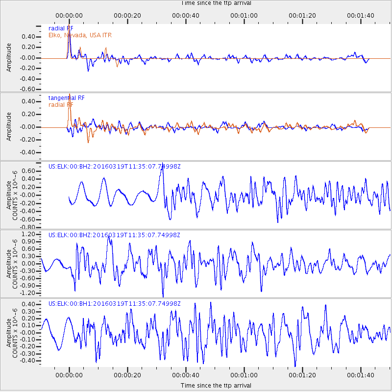
ELK Elko, Nevada, USA - Earthquake Result Viewer
*The percent match for this event was below the threshold and hence no stack was calculated.
| Earthquake location: |
Leeward Islands |
| Earthquake latitude/longitude: |
18.0/-60.7 |
| Earthquake time(UTC): |
2016/03/19 (079) 11:26:34 GMT |
| Earthquake Depth: |
32 km |
| Earthquake Magnitude: |
6.0 MWW, 5.9 MWB |
| Earthquake Catalog/Contributor: |
NEIC PDE/NEIC COMCAT |
|
| Network: |
US United States National Seismic Network |
| Station: |
ELK Elko, Nevada, USA |
| Lat/Lon: |
40.74 N/115.24 W |
| Elevation: |
2210 m |
|
| Distance: |
51.7 deg |
| Az: |
307.998 deg |
| Baz: |
99.213 deg |
| Ray Param: |
$rayparam |
*The percent match for this event was below the threshold and hence was not used in the summary stack. |
|
| Radial Match: |
54.163143 % |
| Radial Bump: |
376 |
| Transverse Match: |
52.70806 % |
| Transverse Bump: |
400 |
| SOD ConfigId: |
1464191 |
| Insert Time: |
2016-04-02 12:07:40.554 +0000 |
| GWidth: |
2.5 |
| Max Bumps: |
400 |
| Tol: |
0.001 |
|
Signal To Noise
| Channel | StoN | STA | LTA |
| US:ELK:00:BHZ:20160319T11:35:07.74998Z | 2.27764 | 5.017385E-7 | 2.2028875E-7 |
| US:ELK:00:BH1:20160319T11:35:07.74998Z | 1.262098 | 1.385027E-7 | 1.0974006E-7 |
| US:ELK:00:BH2:20160319T11:35:07.74998Z | 2.175654 | 3.9973366E-7 | 1.8373035E-7 |
| Arrivals |
| Ps | |
| PpPs | |
| PsPs/PpSs | |


