You are here: Home > Network List > CI - Caltech Regional Seismic Network Stations List
> Station SMM Simmler, CA, USA > Earthquake Result Viewer
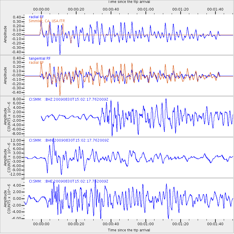
SMM Simmler, CA, USA - Earthquake Result Viewer
*The percent match for this event was below the threshold and hence no stack was calculated.
| Earthquake location: |
Samoa Islands Region |
| Earthquake latitude/longitude: |
-15.2/-172.6 |
| Earthquake time(UTC): |
2009/08/30 (242) 14:51:32 GMT |
| Earthquake Depth: |
11 km |
| Earthquake Magnitude: |
6.4 MB, 6.3 MS, 6.6 MW, 6.6 MW |
| Earthquake Catalog/Contributor: |
WHDF/NEIC |
|
| Network: |
CI Caltech Regional Seismic Network |
| Station: |
SMM Simmler, CA, USA |
| Lat/Lon: |
35.31 N/120.00 W |
| Elevation: |
599 m |
|
| Distance: |
70.8 deg |
| Az: |
43.466 deg |
| Baz: |
234.294 deg |
| Ray Param: |
$rayparam |
*The percent match for this event was below the threshold and hence was not used in the summary stack. |
|
| Radial Match: |
77.78577 % |
| Radial Bump: |
400 |
| Transverse Match: |
79.428764 % |
| Transverse Bump: |
400 |
| SOD ConfigId: |
2622 |
| Insert Time: |
2010-02-26 01:32:41.861 +0000 |
| GWidth: |
2.5 |
| Max Bumps: |
400 |
| Tol: |
0.001 |
|
Signal To Noise
| Channel | StoN | STA | LTA |
| CI:SMM: :BHN:20090830T15:02:17.762009Z | 6.9818573 | 3.7271495E-6 | 5.3383354E-7 |
| CI:SMM: :BHE:20090830T15:02:17.762009Z | 1.2053794 | 9.1391973E-7 | 7.582009E-7 |
| CI:SMM: :BHZ:20090830T15:02:17.762009Z | 1.7985513 | 1.290959E-6 | 7.177771E-7 |
| Arrivals |
| Ps | |
| PpPs | |
| PsPs/PpSs | |


