You are here: Home > Network List > TA - USArray Transportable Network (new EarthScope stations) Stations List
> Station I13A Wildhorse Creek, Mackay, ID, USA > Earthquake Result Viewer
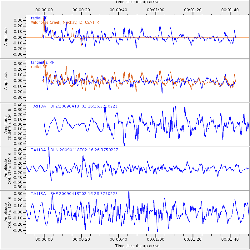
I13A Wildhorse Creek, Mackay, ID, USA - Earthquake Result Viewer
*The percent match for this event was below the threshold and hence no stack was calculated.
| Earthquake location: |
Kermadec Islands Region |
| Earthquake latitude/longitude: |
-28.9/-177.4 |
| Earthquake time(UTC): |
2009/04/18 (108) 02:03:52 GMT |
| Earthquake Depth: |
65 km |
| Earthquake Magnitude: |
6.0 MB, 5.8 MW, 5.7 MW |
| Earthquake Catalog/Contributor: |
WHDF/NEIC |
|
| Network: |
TA USArray Transportable Network (new EarthScope stations) |
| Station: |
I13A Wildhorse Creek, Mackay, ID, USA |
| Lat/Lon: |
43.91 N/114.12 W |
| Elevation: |
2104 m |
|
| Distance: |
92.8 deg |
| Az: |
40.282 deg |
| Baz: |
231.658 deg |
| Ray Param: |
$rayparam |
*The percent match for this event was below the threshold and hence was not used in the summary stack. |
|
| Radial Match: |
67.100624 % |
| Radial Bump: |
400 |
| Transverse Match: |
47.64371 % |
| Transverse Bump: |
400 |
| SOD ConfigId: |
2658 |
| Insert Time: |
2010-03-06 05:26:10.743 +0000 |
| GWidth: |
2.5 |
| Max Bumps: |
400 |
| Tol: |
0.001 |
|
Signal To Noise
| Channel | StoN | STA | LTA |
| TA:I13A: :BHN:20090418T02:16:26.375022Z | 3.3656056 | 3.2475495E-7 | 9.649227E-8 |
| TA:I13A: :BHE:20090418T02:16:26.375022Z | 3.1932368 | 1.4263856E-7 | 4.4668955E-8 |
| TA:I13A: :BHZ:20090418T02:16:26.375022Z | 1.8762448 | 1.576362E-7 | 8.4016854E-8 |
| Arrivals |
| Ps | |
| PpPs | |
| PsPs/PpSs | |


