You are here: Home > Network List > US - United States National Seismic Network Stations List
> Station NEW Newport, Washington, USA > Earthquake Result Viewer
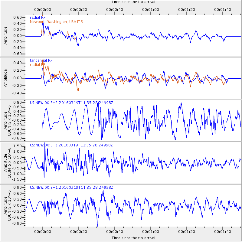
NEW Newport, Washington, USA - Earthquake Result Viewer
*The percent match for this event was below the threshold and hence no stack was calculated.
| Earthquake location: |
Leeward Islands |
| Earthquake latitude/longitude: |
18.0/-60.7 |
| Earthquake time(UTC): |
2016/03/19 (079) 11:26:34 GMT |
| Earthquake Depth: |
32 km |
| Earthquake Magnitude: |
6.0 MWW, 5.9 MWB |
| Earthquake Catalog/Contributor: |
NEIC PDE/NEIC COMCAT |
|
| Network: |
US United States National Seismic Network |
| Station: |
NEW Newport, Washington, USA |
| Lat/Lon: |
48.26 N/117.12 W |
| Elevation: |
760 m |
|
| Distance: |
54.5 deg |
| Az: |
316.886 deg |
| Baz: |
103.236 deg |
| Ray Param: |
$rayparam |
*The percent match for this event was below the threshold and hence was not used in the summary stack. |
|
| Radial Match: |
72.51078 % |
| Radial Bump: |
400 |
| Transverse Match: |
64.22045 % |
| Transverse Bump: |
400 |
| SOD ConfigId: |
1464191 |
| Insert Time: |
2016-04-02 12:08:27.335 +0000 |
| GWidth: |
2.5 |
| Max Bumps: |
400 |
| Tol: |
0.001 |
|
Signal To Noise
| Channel | StoN | STA | LTA |
| US:NEW:00:BHZ:20160319T11:35:28.24998Z | 2.83199 | 6.069847E-7 | 2.1433154E-7 |
| US:NEW:00:BH1:20160319T11:35:28.24998Z | 1.1006184 | 2.2257076E-7 | 2.0222338E-7 |
| US:NEW:00:BH2:20160319T11:35:28.24998Z | 1.397457 | 4.730029E-7 | 3.3847402E-7 |
| Arrivals |
| Ps | |
| PpPs | |
| PsPs/PpSs | |


