You are here: Home > Network List > TA - USArray Transportable Network (new EarthScope stations) Stations List
> Station I13A Wildhorse Creek, Mackay, ID, USA > Earthquake Result Viewer
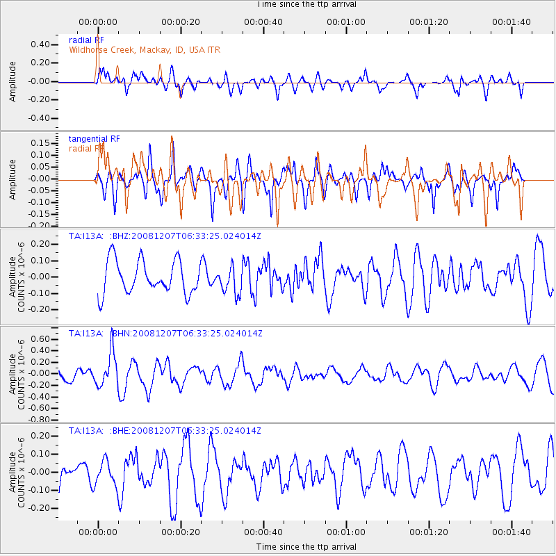
I13A Wildhorse Creek, Mackay, ID, USA - Earthquake Result Viewer
*The percent match for this event was below the threshold and hence no stack was calculated.
| Earthquake location: |
Northern Mid-Atlantic Ridge |
| Earthquake latitude/longitude: |
13.4/-44.8 |
| Earthquake time(UTC): |
2008/12/07 (342) 06:23:09 GMT |
| Earthquake Depth: |
10 km |
| Earthquake Magnitude: |
5.6 MB, 5.3 MS, 5.7 MW |
| Earthquake Catalog/Contributor: |
WHDF/NEIC |
|
| Network: |
TA USArray Transportable Network (new EarthScope stations) |
| Station: |
I13A Wildhorse Creek, Mackay, ID, USA |
| Lat/Lon: |
43.91 N/114.12 W |
| Elevation: |
2104 m |
|
| Distance: |
66.0 deg |
| Az: |
312.253 deg |
| Baz: |
94.527 deg |
| Ray Param: |
$rayparam |
*The percent match for this event was below the threshold and hence was not used in the summary stack. |
|
| Radial Match: |
68.844376 % |
| Radial Bump: |
400 |
| Transverse Match: |
69.22442 % |
| Transverse Bump: |
400 |
| SOD ConfigId: |
2658 |
| Insert Time: |
2010-03-06 05:26:16.795 +0000 |
| GWidth: |
2.5 |
| Max Bumps: |
400 |
| Tol: |
0.001 |
|
Signal To Noise
| Channel | StoN | STA | LTA |
| TA:I13A: :BHN:20081207T06:33:25.024014Z | 2.40603 | 3.095216E-7 | 1.2864412E-7 |
| TA:I13A: :BHE:20081207T06:33:25.024014Z | 0.71972024 | 6.787468E-8 | 9.430703E-8 |
| TA:I13A: :BHZ:20081207T06:33:25.024014Z | 0.8438024 | 8.479471E-8 | 1.004912E-7 |
| Arrivals |
| Ps | |
| PpPs | |
| PsPs/PpSs | |


