You are here: Home > Network List > CI - Caltech Regional Seismic Network Stations List
> Station SMM Simmler, CA, USA > Earthquake Result Viewer
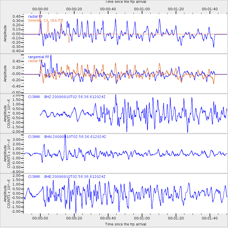
SMM Simmler, CA, USA - Earthquake Result Viewer
*The percent match for this event was below the threshold and hence no stack was calculated.
| Earthquake location: |
Kuril Islands |
| Earthquake latitude/longitude: |
48.3/154.2 |
| Earthquake time(UTC): |
2009/09/10 (253) 02:46:50 GMT |
| Earthquake Depth: |
36 km |
| Earthquake Magnitude: |
6.0 MB, 5.5 MS, 6.0 MW, 5.8 MW |
| Earthquake Catalog/Contributor: |
WHDF/NEIC |
|
| Network: |
CI Caltech Regional Seismic Network |
| Station: |
SMM Simmler, CA, USA |
| Lat/Lon: |
35.31 N/120.00 W |
| Elevation: |
599 m |
|
| Distance: |
62.1 deg |
| Az: |
67.392 deg |
| Baz: |
311.108 deg |
| Ray Param: |
$rayparam |
*The percent match for this event was below the threshold and hence was not used in the summary stack. |
|
| Radial Match: |
66.92093 % |
| Radial Bump: |
400 |
| Transverse Match: |
77.61318 % |
| Transverse Bump: |
400 |
| SOD ConfigId: |
2622 |
| Insert Time: |
2010-02-26 01:32:44.443 +0000 |
| GWidth: |
2.5 |
| Max Bumps: |
400 |
| Tol: |
0.001 |
|
Signal To Noise
| Channel | StoN | STA | LTA |
| CI:SMM: :BHN:20090910T02:56:36.612024Z | 4.0123343 | 9.0923663E-7 | 2.266104E-7 |
| CI:SMM: :BHE:20090910T02:56:36.612024Z | 1.4950699 | 6.567445E-7 | 4.392734E-7 |
| CI:SMM: :BHZ:20090910T02:56:36.612024Z | 1.7467571 | 4.9402877E-7 | 2.8282625E-7 |
| Arrivals |
| Ps | |
| PpPs | |
| PsPs/PpSs | |


