You are here: Home > Network List > TA - USArray Transportable Network (new EarthScope stations) Stations List
> Station G21K Allakaket, AK, USA > Earthquake Result Viewer
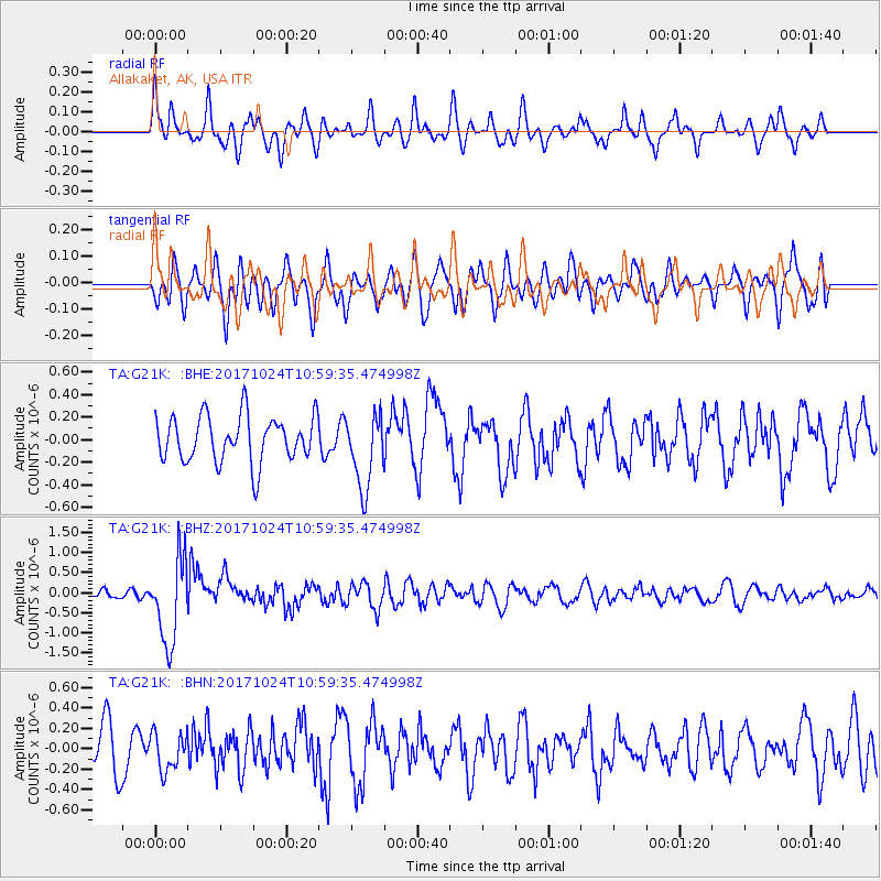
G21K Allakaket, AK, USA - Earthquake Result Viewer
*The percent match for this event was below the threshold and hence no stack was calculated.
| Earthquake location: |
Banda Sea |
| Earthquake latitude/longitude: |
-7.2/123.0 |
| Earthquake time(UTC): |
2017/10/24 (297) 10:47:47 GMT |
| Earthquake Depth: |
549 km |
| Earthquake Magnitude: |
6.7 Mww |
| Earthquake Catalog/Contributor: |
NEIC PDE/us |
|
| Network: |
TA USArray Transportable Network (new EarthScope stations) |
| Station: |
G21K Allakaket, AK, USA |
| Lat/Lon: |
66.52 N/153.51 W |
| Elevation: |
446 m |
|
| Distance: |
94.0 deg |
| Az: |
23.522 deg |
| Baz: |
261.133 deg |
| Ray Param: |
$rayparam |
*The percent match for this event was below the threshold and hence was not used in the summary stack. |
|
| Radial Match: |
65.23753 % |
| Radial Bump: |
400 |
| Transverse Match: |
61.877758 % |
| Transverse Bump: |
400 |
| SOD ConfigId: |
13570011 |
| Insert Time: |
2019-04-29 00:29:32.445 +0000 |
| GWidth: |
2.5 |
| Max Bumps: |
400 |
| Tol: |
0.001 |
|
Signal To Noise
| Channel | StoN | STA | LTA |
| TA:G21K: :BHZ:20171024T10:59:35.474998Z | 7.0828404 | 1.0574526E-6 | 1.492978E-7 |
| TA:G21K: :BHN:20171024T10:59:35.474998Z | 0.91681975 | 1.83058E-7 | 1.996663E-7 |
| TA:G21K: :BHE:20171024T10:59:35.474998Z | 1.6232833 | 3.3070174E-7 | 2.0372397E-7 |
| Arrivals |
| Ps | |
| PpPs | |
| PsPs/PpSs | |


