You are here: Home > Network List > TA - USArray Transportable Network (new EarthScope stations) Stations List
> Station I13A Wildhorse Creek, Mackay, ID, USA > Earthquake Result Viewer
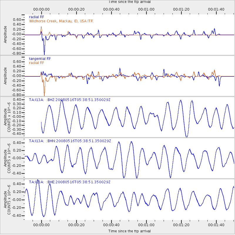
I13A Wildhorse Creek, Mackay, ID, USA - Earthquake Result Viewer
*The percent match for this event was below the threshold and hence no stack was calculated.
| Earthquake location: |
Sichuan, China |
| Earthquake latitude/longitude: |
31.4/103.4 |
| Earthquake time(UTC): |
2008/05/16 (137) 05:25:47 GMT |
| Earthquake Depth: |
3.0 km |
| Earthquake Magnitude: |
5.5 MB, 5.4 MS, 5.6 MW, 5.6 MW |
| Earthquake Catalog/Contributor: |
WHDF/NEIC |
|
| Network: |
TA USArray Transportable Network (new EarthScope stations) |
| Station: |
I13A Wildhorse Creek, Mackay, ID, USA |
| Lat/Lon: |
43.91 N/114.12 W |
| Elevation: |
2104 m |
|
| Distance: |
97.6 deg |
| Az: |
26.331 deg |
| Baz: |
328.327 deg |
| Ray Param: |
$rayparam |
*The percent match for this event was below the threshold and hence was not used in the summary stack. |
|
| Radial Match: |
78.66885 % |
| Radial Bump: |
400 |
| Transverse Match: |
47.799175 % |
| Transverse Bump: |
400 |
| SOD ConfigId: |
2504 |
| Insert Time: |
2010-03-06 05:26:53.388 +0000 |
| GWidth: |
2.5 |
| Max Bumps: |
400 |
| Tol: |
0.001 |
|
Signal To Noise
| Channel | StoN | STA | LTA |
| TA:I13A: :BHN:20080516T05:38:51.350029Z | 1.0078903 | 7.7924845E-8 | 7.73148E-8 |
| TA:I13A: :BHE:20080516T05:38:51.350029Z | 1.6999215 | 2.9226132E-7 | 1.7192636E-7 |
| TA:I13A: :BHZ:20080516T05:38:51.350029Z | 0.70590216 | 1.6178382E-7 | 2.2918732E-7 |
| Arrivals |
| Ps | |
| PpPs | |
| PsPs/PpSs | |


