You are here: Home > Network List > CI - Caltech Regional Seismic Network Stations List
> Station SMM Simmler, CA, USA > Earthquake Result Viewer
SMM Simmler, CA, USA - Earthquake Result Viewer
*The percent match for this event was below the threshold and hence no stack was calculated.
| Earthquake location: |
Kuril Islands |
| Earthquake latitude/longitude: |
48.3/154.2 |
| Earthquake time(UTC): |
2009/09/11 (254) 08:49:11 GMT |
| Earthquake Depth: |
35 km |
| Earthquake Magnitude: |
5.8 MB, 5.0 MS, 5.6 MW, 5.6 MW |
| Earthquake Catalog/Contributor: |
WHDF/NEIC |
|
| Network: |
CI Caltech Regional Seismic Network |
| Station: |
SMM Simmler, CA, USA |
| Lat/Lon: |
35.31 N/120.00 W |
| Elevation: |
599 m |
|
| Distance: |
62.1 deg |
| Az: |
67.403 deg |
| Baz: |
311.073 deg |
| Ray Param: |
$rayparam |
*The percent match for this event was below the threshold and hence was not used in the summary stack. |
|
| Radial Match: |
49.004936 % |
| Radial Bump: |
400 |
| Transverse Match: |
55.88174 % |
| Transverse Bump: |
400 |
| SOD ConfigId: |
2622 |
| Insert Time: |
2010-02-26 01:32:47.037 +0000 |
| GWidth: |
2.5 |
| Max Bumps: |
400 |
| Tol: |
0.001 |
|
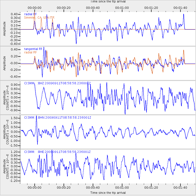
Signal To Noise
| Channel | StoN | STA | LTA |
| CI:SMM: :BHN:20090911T08:58:58.236001Z | 2.4585903 | 6.689915E-7 | 2.7210368E-7 |
| CI:SMM: :BHE:20090911T08:58:58.236001Z | 1.1790717 | 5.026511E-7 | 4.2631092E-7 |
| CI:SMM: :BHZ:20090911T08:58:58.236001Z | 0.9557515 | 3.9257623E-7 | 4.1075137E-7 |
| Arrivals |
| Ps | |
| PpPs | |
| PsPs/PpSs | |


