You are here: Home > Network List > CI - Caltech Regional Seismic Network Stations List
> Station SMM Simmler, CA, USA > Earthquake Result Viewer
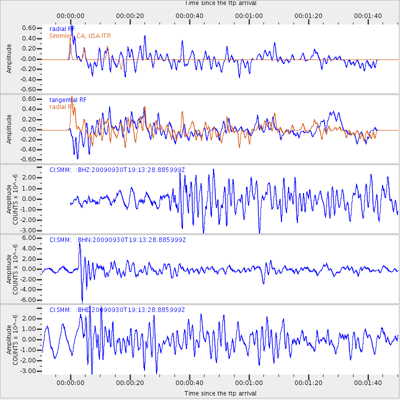
SMM Simmler, CA, USA - Earthquake Result Viewer
*The percent match for this event was below the threshold and hence no stack was calculated.
| Earthquake location: |
Peru-Bolivia Border Region |
| Earthquake latitude/longitude: |
-15.6/-69.3 |
| Earthquake time(UTC): |
2009/09/30 (273) 19:03:17 GMT |
| Earthquake Depth: |
255 km |
| Earthquake Magnitude: |
5.9 MB, 5.8 MW |
| Earthquake Catalog/Contributor: |
WHDF/NEIC |
|
| Network: |
CI Caltech Regional Seismic Network |
| Station: |
SMM Simmler, CA, USA |
| Lat/Lon: |
35.31 N/120.00 W |
| Elevation: |
599 m |
|
| Distance: |
69.8 deg |
| Az: |
317.582 deg |
| Baz: |
127.347 deg |
| Ray Param: |
$rayparam |
*The percent match for this event was below the threshold and hence was not used in the summary stack. |
|
| Radial Match: |
70.710464 % |
| Radial Bump: |
400 |
| Transverse Match: |
63.110405 % |
| Transverse Bump: |
400 |
| SOD ConfigId: |
2622 |
| Insert Time: |
2010-02-26 01:32:48.930 +0000 |
| GWidth: |
2.5 |
| Max Bumps: |
400 |
| Tol: |
0.001 |
|
Signal To Noise
| Channel | StoN | STA | LTA |
| CI:SMM: :BHN:20090930T19:13:28.885999Z | 6.6965313 | 2.1952687E-6 | 3.2782177E-7 |
| CI:SMM: :BHE:20090930T19:13:28.885999Z | 1.5992088 | 1.2129178E-6 | 7.5844866E-7 |
| CI:SMM: :BHZ:20090930T19:13:28.885999Z | 1.2366451 | 5.118402E-7 | 4.1389418E-7 |
| Arrivals |
| Ps | |
| PpPs | |
| PsPs/PpSs | |


