You are here: Home > Network List > TA - USArray Transportable Network (new EarthScope stations) Stations List
> Station B18K Kokolik River, AK, USA > Earthquake Result Viewer
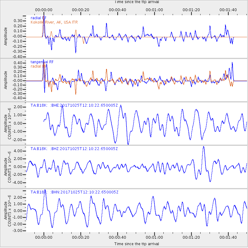
B18K Kokolik River, AK, USA - Earthquake Result Viewer
*The percent match for this event was below the threshold and hence no stack was calculated.
| Earthquake location: |
Banda Sea |
| Earthquake latitude/longitude: |
-4.9/131.1 |
| Earthquake time(UTC): |
2017/10/25 (298) 11:58:14 GMT |
| Earthquake Depth: |
42 km |
| Earthquake Magnitude: |
5.5 Mww |
| Earthquake Catalog/Contributor: |
NEIC PDE/us |
|
| Network: |
TA USArray Transportable Network (new EarthScope stations) |
| Station: |
B18K Kokolik River, AK, USA |
| Lat/Lon: |
69.36 N/161.80 W |
| Elevation: |
222 m |
|
| Distance: |
86.6 deg |
| Az: |
19.096 deg |
| Baz: |
246.863 deg |
| Ray Param: |
$rayparam |
*The percent match for this event was below the threshold and hence was not used in the summary stack. |
|
| Radial Match: |
68.65814 % |
| Radial Bump: |
313 |
| Transverse Match: |
45.00535 % |
| Transverse Bump: |
400 |
| SOD ConfigId: |
13570011 |
| Insert Time: |
2019-04-29 00:33:24.009 +0000 |
| GWidth: |
2.5 |
| Max Bumps: |
400 |
| Tol: |
0.001 |
|
Signal To Noise
| Channel | StoN | STA | LTA |
| TA:B18K: :BHZ:20171025T12:10:22.650005Z | 1.0530429 | 9.20931E-7 | 8.7454265E-7 |
| TA:B18K: :BHN:20171025T12:10:22.650005Z | 2.2304535 | 1.708555E-6 | 7.6601236E-7 |
| TA:B18K: :BHE:20171025T12:10:22.650005Z | 0.685642 | 5.8492265E-7 | 8.531021E-7 |
| Arrivals |
| Ps | |
| PpPs | |
| PsPs/PpSs | |


