You are here: Home > Network List > AK - Alaska Regional Network Stations List
> Station CUT Chulitna, AK, USA > Earthquake Result Viewer
CUT Chulitna, AK, USA - Earthquake Result Viewer
*The percent match for this event was below the threshold and hence no stack was calculated.
| Earthquake location: |
North Of Franz Josef Land |
| Earthquake latitude/longitude: |
86.9/54.5 |
| Earthquake time(UTC): |
2017/10/28 (301) 16:13:54 GMT |
| Earthquake Depth: |
10 km |
| Earthquake Magnitude: |
5.8 Mww |
| Earthquake Catalog/Contributor: |
NEIC PDE/us |
|
| Network: |
AK Alaska Regional Network |
| Station: |
CUT Chulitna, AK, USA |
| Lat/Lon: |
62.41 N/150.26 W |
| Elevation: |
574 m |
|
| Distance: |
30.6 deg |
| Az: |
22.51 deg |
| Baz: |
357.426 deg |
| Ray Param: |
$rayparam |
*The percent match for this event was below the threshold and hence was not used in the summary stack. |
|
| Radial Match: |
62.3702 % |
| Radial Bump: |
400 |
| Transverse Match: |
58.55965 % |
| Transverse Bump: |
400 |
| SOD ConfigId: |
13570011 |
| Insert Time: |
2019-04-29 00:35:00.677 +0000 |
| GWidth: |
2.5 |
| Max Bumps: |
400 |
| Tol: |
0.001 |
|
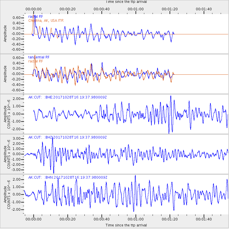
Signal To Noise
| Channel | StoN | STA | LTA |
| AK:CUT: :BHZ:20171028T16:19:37.980009Z | 2.7627864 | 5.4091976E-7 | 1.9578776E-7 |
| AK:CUT: :BHN:20171028T16:19:37.980009Z | 0.94338894 | 4.069062E-7 | 4.3132388E-7 |
| AK:CUT: :BHE:20171028T16:19:37.980009Z | 0.8120133 | 3.3128163E-7 | 4.0797556E-7 |
| Arrivals |
| Ps | |
| PpPs | |
| PsPs/PpSs | |


