218A Dragoon, AZ, USA - Earthquake Result Viewer
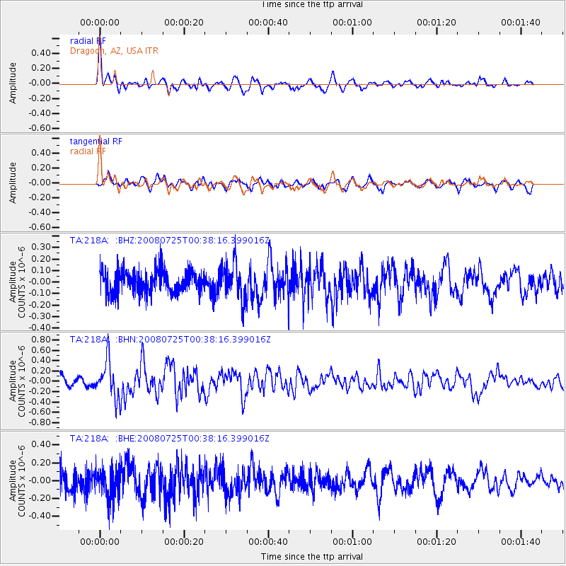
Earthquake location: Rat Islands, Aleutian Islands
Earthquake latitude/longitude: 51.3/179.0
Earthquake time(UTC): 2008/07/25 (207) 00:29:22 GMT
Earthquake Depth: 21 km
Earthquake Magnitude: 5.7 MB, 5.5 MS, 5.9 MW, 5.9 MW
Earthquake Catalog/Contributor: WHDF/NEIC
Network: TA USArray Transportable Network (new EarthScope stations)
Station: 218A Dragoon, AZ, USA
Lat/Lon: 31.97 N/110.05 W
Elevation: 1486 m
Distance: 54.3 deg
Az: 81.829 deg
Baz: 312.986 deg
Ray Param: 0.0655328
Estimated Moho Depth: 37.75 km
Estimated Crust Vp/Vs: 1.60
Assumed Crust Vp: 6.264 km/s
Estimated Crust Vs: 3.915 km/s
Estimated Crust Poisson's Ratio: 0.18
Radial Match: 82.305 %
Radial Bump: 400
Transverse Match: 65.87588 %
Transverse Bump: 400
SOD ConfigId: 2504
Insert Time: 2010-03-06 05:27:50.009 +0000
GWidth: 2.5
Max Bumps: 400
Tol: 0.001

Signal To Noise

ChannelStoNSTALTA
TA:218A: :BHN:20080725T00:38:16.399016Z3.92574883.7135186E-79.4593894E-8
TA:218A: :BHE:20080725T00:38:16.399016Z1.3200151.7877257E-71.3543223E-7
TA:218A: :BHZ:20080725T00:38:16.399016Z1.64054261.6317361E-79.946319E-8
Arrivals
Ps3.8 SECOND
PpPs15 SECOND
PsPs/PpSs19 SECOND