You are here: Home > Network List > CI - Caltech Regional Seismic Network Stations List
> Station SMM Simmler, CA, USA > Earthquake Result Viewer
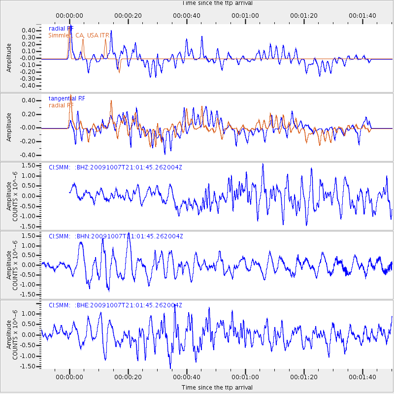
SMM Simmler, CA, USA - Earthquake Result Viewer
*The percent match for this event was below the threshold and hence no stack was calculated.
| Earthquake location: |
East Of Severnaya Zemlya |
| Earthquake latitude/longitude: |
81.6/119.5 |
| Earthquake time(UTC): |
2009/10/07 (280) 20:52:13 GMT |
| Earthquake Depth: |
8.0 km |
| Earthquake Magnitude: |
5.7 MB, 5.1 MS, 5.8 MW, 5.8 MW |
| Earthquake Catalog/Contributor: |
WHDF/NEIC |
|
| Network: |
CI Caltech Regional Seismic Network |
| Station: |
SMM Simmler, CA, USA |
| Lat/Lon: |
35.31 N/120.00 W |
| Elevation: |
599 m |
|
| Distance: |
59.5 deg |
| Az: |
54.917 deg |
| Baz: |
351.511 deg |
| Ray Param: |
$rayparam |
*The percent match for this event was below the threshold and hence was not used in the summary stack. |
|
| Radial Match: |
53.624023 % |
| Radial Bump: |
400 |
| Transverse Match: |
61.777554 % |
| Transverse Bump: |
400 |
| SOD ConfigId: |
2622 |
| Insert Time: |
2010-02-26 01:32:53.961 +0000 |
| GWidth: |
2.5 |
| Max Bumps: |
400 |
| Tol: |
0.001 |
|
Signal To Noise
| Channel | StoN | STA | LTA |
| CI:SMM: :BHN:20091007T21:01:45.262004Z | 4.862863 | 6.244403E-7 | 1.2841002E-7 |
| CI:SMM: :BHE:20091007T21:01:45.262004Z | 1.2721959 | 3.645893E-7 | 2.865827E-7 |
| CI:SMM: :BHZ:20091007T21:01:45.262004Z | 1.322577 | 3.0637912E-7 | 2.3165315E-7 |
| Arrivals |
| Ps | |
| PpPs | |
| PsPs/PpSs | |


