You are here: Home > Network List > TA - USArray Transportable Network (new EarthScope stations) Stations List
> Station N23A Red Feather Lakes, CO, USA > Earthquake Result Viewer
N23A Red Feather Lakes, CO, USA - Earthquake Result Viewer
*The percent match for this event was below the threshold and hence no stack was calculated.
| Earthquake location: |
North Of Franz Josef Land |
| Earthquake latitude/longitude: |
86.9/54.5 |
| Earthquake time(UTC): |
2017/10/28 (301) 16:13:54 GMT |
| Earthquake Depth: |
10 km |
| Earthquake Magnitude: |
5.8 Mww |
| Earthquake Catalog/Contributor: |
NEIC PDE/us |
|
| Network: |
TA USArray Transportable Network (new EarthScope stations) |
| Station: |
N23A Red Feather Lakes, CO, USA |
| Lat/Lon: |
40.89 N/105.94 W |
| Elevation: |
2458 m |
|
| Distance: |
52.3 deg |
| Az: |
341.278 deg |
| Baz: |
1.325 deg |
| Ray Param: |
$rayparam |
*The percent match for this event was below the threshold and hence was not used in the summary stack. |
|
| Radial Match: |
57.802208 % |
| Radial Bump: |
400 |
| Transverse Match: |
59.625237 % |
| Transverse Bump: |
400 |
| SOD ConfigId: |
13570011 |
| Insert Time: |
2019-04-29 00:41:59.937 +0000 |
| GWidth: |
2.5 |
| Max Bumps: |
400 |
| Tol: |
0.001 |
|
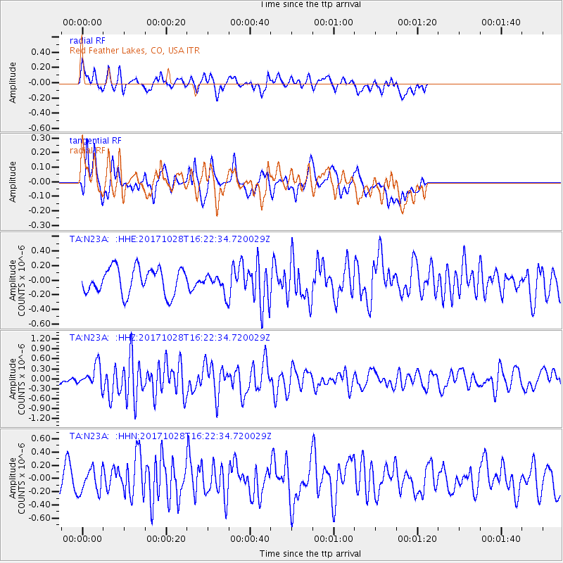
Signal To Noise
| Channel | StoN | STA | LTA |
| TA:N23A: :HHZ:20171028T16:22:34.720029Z | 2.2378 | 3.3677927E-7 | 1.504957E-7 |
| TA:N23A: :HHN:20171028T16:22:34.720029Z | 1.5557824 | 1.7863456E-7 | 1.14819755E-7 |
| TA:N23A: :HHE:20171028T16:22:34.720029Z | 0.7249259 | 1.2886613E-7 | 1.7776456E-7 |
| Arrivals |
| Ps | |
| PpPs | |
| PsPs/PpSs | |


