You are here: Home > Network List > TA - USArray Transportable Network (new EarthScope stations) Stations List
> Station R32K Eaglecrest, AK, USA > Earthquake Result Viewer
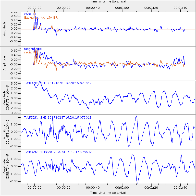
R32K Eaglecrest, AK, USA - Earthquake Result Viewer
*The percent match for this event was below the threshold and hence no stack was calculated.
| Earthquake location: |
North Of Franz Josef Land |
| Earthquake latitude/longitude: |
86.9/54.5 |
| Earthquake time(UTC): |
2017/10/28 (301) 16:13:54 GMT |
| Earthquake Depth: |
10 km |
| Earthquake Magnitude: |
5.8 Mww |
| Earthquake Catalog/Contributor: |
NEIC PDE/us |
|
| Network: |
TA USArray Transportable Network (new EarthScope stations) |
| Station: |
R32K Eaglecrest, AK, USA |
| Lat/Lon: |
58.27 N/134.52 W |
| Elevation: |
386 m |
|
| Distance: |
35.0 deg |
| Az: |
8.3 deg |
| Baz: |
359.145 deg |
| Ray Param: |
$rayparam |
*The percent match for this event was below the threshold and hence was not used in the summary stack. |
|
| Radial Match: |
76.62799 % |
| Radial Bump: |
367 |
| Transverse Match: |
44.96176 % |
| Transverse Bump: |
400 |
| SOD ConfigId: |
13570011 |
| Insert Time: |
2019-04-29 00:42:11.046 +0000 |
| GWidth: |
2.5 |
| Max Bumps: |
400 |
| Tol: |
0.001 |
|
Signal To Noise
| Channel | StoN | STA | LTA |
| TA:R32K: :BHZ:20171028T16:20:16.07501Z | 1.2545801 | 7.0663833E-7 | 5.6324683E-7 |
| TA:R32K: :BHN:20171028T16:20:16.07501Z | 0.79264665 | 6.280826E-7 | 7.9238663E-7 |
| TA:R32K: :BHE:20171028T16:20:16.07501Z | 1.5071619 | 1.805316E-6 | 1.1978249E-6 |
| Arrivals |
| Ps | |
| PpPs | |
| PsPs/PpSs | |


