You are here: Home > Network List > CI - Caltech Regional Seismic Network Stations List
> Station SMM Simmler, CA, USA > Earthquake Result Viewer
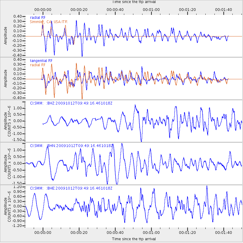
SMM Simmler, CA, USA - Earthquake Result Viewer
*The percent match for this event was below the threshold and hence no stack was calculated.
| Earthquake location: |
Santa Cruz Islands |
| Earthquake latitude/longitude: |
-12.4/166.5 |
| Earthquake time(UTC): |
2009/10/12 (285) 09:37:21 GMT |
| Earthquake Depth: |
42 km |
| Earthquake Magnitude: |
5.9 MB, 5.9 MS, 6.2 MW, 6.2 MW |
| Earthquake Catalog/Contributor: |
WHDF/NEIC |
|
| Network: |
CI Caltech Regional Seismic Network |
| Station: |
SMM Simmler, CA, USA |
| Lat/Lon: |
35.31 N/120.00 W |
| Elevation: |
599 m |
|
| Distance: |
84.0 deg |
| Az: |
52.039 deg |
| Baz: |
250.359 deg |
| Ray Param: |
$rayparam |
*The percent match for this event was below the threshold and hence was not used in the summary stack. |
|
| Radial Match: |
71.13159 % |
| Radial Bump: |
400 |
| Transverse Match: |
74.82517 % |
| Transverse Bump: |
400 |
| SOD ConfigId: |
2622 |
| Insert Time: |
2010-02-26 01:33:02.601 +0000 |
| GWidth: |
2.5 |
| Max Bumps: |
400 |
| Tol: |
0.001 |
|
Signal To Noise
| Channel | StoN | STA | LTA |
| CI:SMM: :BHN:20091012T09:49:16.461018Z | 4.4382925 | 6.8669704E-7 | 1.5472098E-7 |
| CI:SMM: :BHE:20091012T09:49:16.461018Z | 2.0625374 | 4.751153E-7 | 2.3035474E-7 |
| CI:SMM: :BHZ:20091012T09:49:16.461018Z | 1.6186243 | 3.1640727E-7 | 1.9547913E-7 |
| Arrivals |
| Ps | |
| PpPs | |
| PsPs/PpSs | |


