You are here: Home > Network List > LD - Lamont-Doherty Cooperative Seismographic Network Stations List
> Station WUPA West Chester University of Pennsylvania > Earthquake Result Viewer
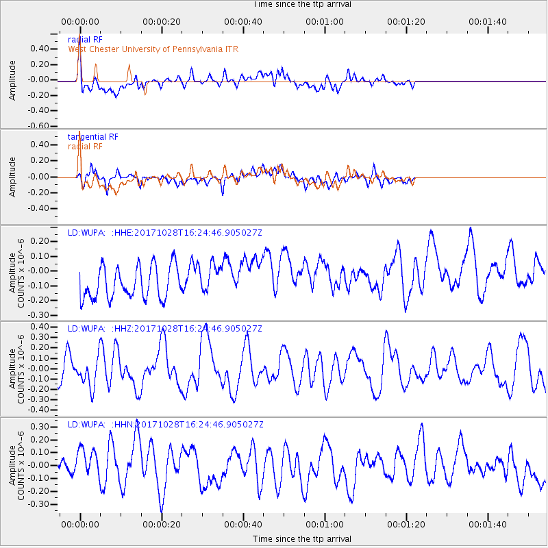
WUPA West Chester University of Pennsylvania - Earthquake Result Viewer
*The percent match for this event was below the threshold and hence no stack was calculated.
| Earthquake location: |
North Of Franz Josef Land |
| Earthquake latitude/longitude: |
86.9/52.8 |
| Earthquake time(UTC): |
2017/10/28 (301) 16:16:06 GMT |
| Earthquake Depth: |
10 km |
| Earthquake Magnitude: |
5.8 Mww |
| Earthquake Catalog/Contributor: |
NEIC PDE/us |
|
| Network: |
LD Lamont-Doherty Cooperative Seismographic Network |
| Station: |
WUPA West Chester University of Pennsylvania |
| Lat/Lon: |
39.93 N/75.61 W |
| Elevation: |
86 m |
|
| Distance: |
52.2 deg |
| Az: |
310.395 deg |
| Baz: |
3.099 deg |
| Ray Param: |
$rayparam |
*The percent match for this event was below the threshold and hence was not used in the summary stack. |
|
| Radial Match: |
55.707474 % |
| Radial Bump: |
400 |
| Transverse Match: |
40.077915 % |
| Transverse Bump: |
400 |
| SOD ConfigId: |
13570011 |
| Insert Time: |
2019-04-29 00:47:42.226 +0000 |
| GWidth: |
2.5 |
| Max Bumps: |
400 |
| Tol: |
0.001 |
|
Signal To Noise
| Channel | StoN | STA | LTA |
| LD:WUPA: :HHZ:20171028T16:24:46.905027Z | 0.93568796 | 1.4080923E-7 | 1.5048738E-7 |
| LD:WUPA: :HHN:20171028T16:24:46.905027Z | 1.849843 | 1.4709963E-7 | 7.9520056E-8 |
| LD:WUPA: :HHE:20171028T16:24:46.905027Z | 0.95798767 | 1.03019616E-7 | 1.0753751E-7 |
| Arrivals |
| Ps | |
| PpPs | |
| PsPs/PpSs | |


