You are here: Home > Network List > UW - Pacific Northwest Regional Seismic Network Stations List
> Station LON Longmire CREST broad-band > Earthquake Result Viewer
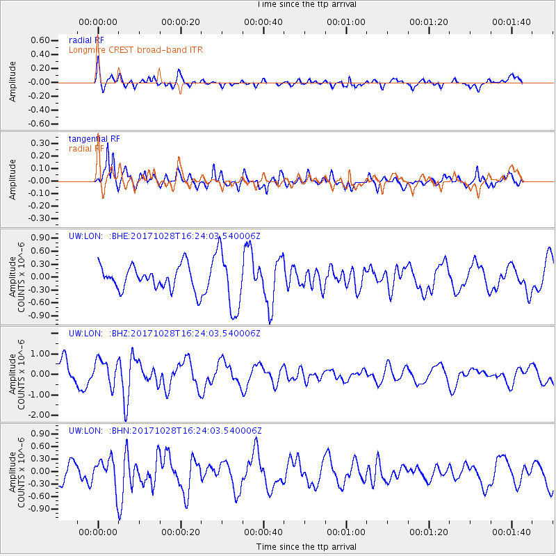
LON Longmire CREST broad-band - Earthquake Result Viewer
*The percent match for this event was below the threshold and hence no stack was calculated.
| Earthquake location: |
North Of Franz Josef Land |
| Earthquake latitude/longitude: |
86.9/52.8 |
| Earthquake time(UTC): |
2017/10/28 (301) 16:16:06 GMT |
| Earthquake Depth: |
10 km |
| Earthquake Magnitude: |
5.8 Mww |
| Earthquake Catalog/Contributor: |
NEIC PDE/us |
|
| Network: |
UW Pacific Northwest Regional Seismic Network |
| Station: |
LON Longmire CREST broad-band |
| Lat/Lon: |
46.75 N/121.81 W |
| Elevation: |
853 m |
|
| Distance: |
46.6 deg |
| Az: |
354.942 deg |
| Baz: |
0.401 deg |
| Ray Param: |
$rayparam |
*The percent match for this event was below the threshold and hence was not used in the summary stack. |
|
| Radial Match: |
51.708485 % |
| Radial Bump: |
362 |
| Transverse Match: |
59.822124 % |
| Transverse Bump: |
400 |
| SOD ConfigId: |
13570011 |
| Insert Time: |
2019-04-29 00:51:14.530 +0000 |
| GWidth: |
2.5 |
| Max Bumps: |
400 |
| Tol: |
0.001 |
|
Signal To Noise
| Channel | StoN | STA | LTA |
| UW:LON: :BHZ:20171028T16:24:03.540006Z | 1.1328671 | 6.559912E-7 | 5.79054E-7 |
| UW:LON: :BHN:20171028T16:24:03.540006Z | 1.562947 | 3.5425668E-7 | 2.2665942E-7 |
| UW:LON: :BHE:20171028T16:24:03.540006Z | 2.6109736 | 6.984232E-7 | 2.6749532E-7 |
| Arrivals |
| Ps | |
| PpPs | |
| PsPs/PpSs | |


