You are here: Home > Network List > UW - Pacific Northwest Regional Seismic Network Stations List
> Station YACT Amboy, WA, USA > Earthquake Result Viewer
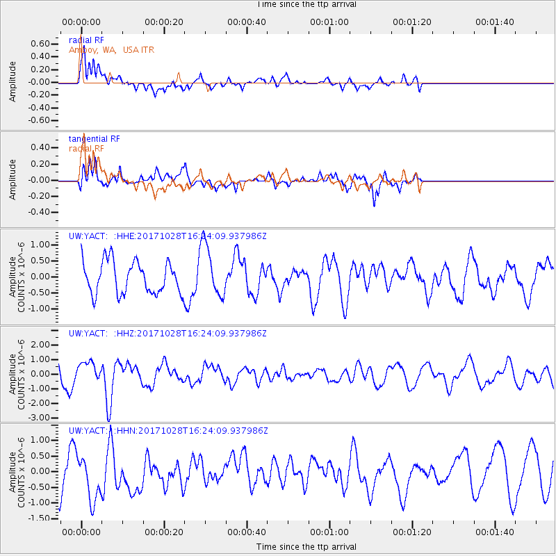
YACT Amboy, WA, USA - Earthquake Result Viewer
*The percent match for this event was below the threshold and hence no stack was calculated.
| Earthquake location: |
North Of Franz Josef Land |
| Earthquake latitude/longitude: |
86.9/52.8 |
| Earthquake time(UTC): |
2017/10/28 (301) 16:16:06 GMT |
| Earthquake Depth: |
10 km |
| Earthquake Magnitude: |
5.8 Mww |
| Earthquake Catalog/Contributor: |
NEIC PDE/us |
|
| Network: |
UW Pacific Northwest Regional Seismic Network |
| Station: |
YACT Amboy, WA, USA |
| Lat/Lon: |
45.93 N/122.42 W |
| Elevation: |
211 m |
|
| Distance: |
47.4 deg |
| Az: |
355.513 deg |
| Baz: |
0.351 deg |
| Ray Param: |
$rayparam |
*The percent match for this event was below the threshold and hence was not used in the summary stack. |
|
| Radial Match: |
69.48646 % |
| Radial Bump: |
400 |
| Transverse Match: |
59.858814 % |
| Transverse Bump: |
400 |
| SOD ConfigId: |
13570011 |
| Insert Time: |
2019-04-29 00:51:19.344 +0000 |
| GWidth: |
2.5 |
| Max Bumps: |
400 |
| Tol: |
0.001 |
|
Signal To Noise
| Channel | StoN | STA | LTA |
| UW:YACT: :HHZ:20171028T16:24:09.937986Z | 1.0133346 | 6.425605E-7 | 6.3410494E-7 |
| UW:YACT: :HHN:20171028T16:24:09.937986Z | 1.27053 | 7.3490327E-7 | 5.784226E-7 |
| UW:YACT: :HHE:20171028T16:24:09.937986Z | 1.6642513 | 8.2863806E-7 | 4.979044E-7 |
| Arrivals |
| Ps | |
| PpPs | |
| PsPs/PpSs | |


