You are here: Home > Network List > CI - Caltech Regional Seismic Network Stations List
> Station SMM Simmler, CA, USA > Earthquake Result Viewer
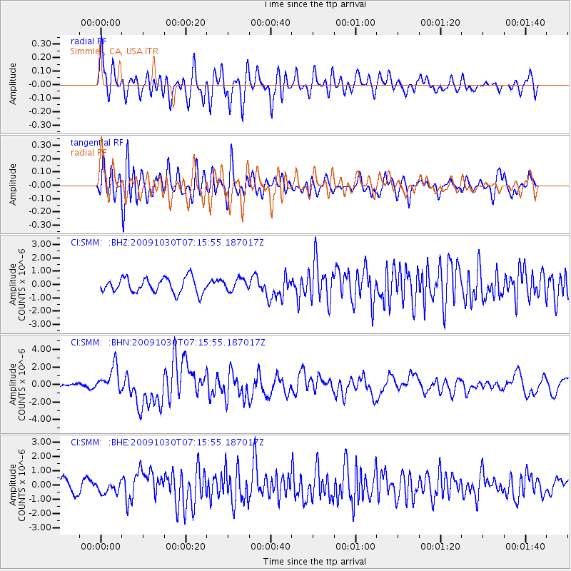
SMM Simmler, CA, USA - Earthquake Result Viewer
*The percent match for this event was below the threshold and hence no stack was calculated.
| Earthquake location: |
Ryukyu Islands, Japan |
| Earthquake latitude/longitude: |
29.2/129.8 |
| Earthquake time(UTC): |
2009/10/30 (303) 07:03:39 GMT |
| Earthquake Depth: |
34 km |
| Earthquake Magnitude: |
6.3 MB, 6.8 MS, 6.8 MW, 6.8 MW |
| Earthquake Catalog/Contributor: |
WHDF/NEIC |
|
| Network: |
CI Caltech Regional Seismic Network |
| Station: |
SMM Simmler, CA, USA |
| Lat/Lon: |
35.31 N/120.00 W |
| Elevation: |
599 m |
|
| Distance: |
88.1 deg |
| Az: |
50.158 deg |
| Baz: |
304.845 deg |
| Ray Param: |
$rayparam |
*The percent match for this event was below the threshold and hence was not used in the summary stack. |
|
| Radial Match: |
74.00168 % |
| Radial Bump: |
400 |
| Transverse Match: |
72.40068 % |
| Transverse Bump: |
400 |
| SOD ConfigId: |
2622 |
| Insert Time: |
2010-02-26 01:33:06.735 +0000 |
| GWidth: |
2.5 |
| Max Bumps: |
400 |
| Tol: |
0.001 |
|
Signal To Noise
| Channel | StoN | STA | LTA |
| CI:SMM: :BHN:20091030T07:15:55.187017Z | 5.217333 | 1.5295985E-6 | 2.9317636E-7 |
| CI:SMM: :BHE:20091030T07:15:55.187017Z | 0.96991503 | 3.9790322E-7 | 4.1024543E-7 |
| CI:SMM: :BHZ:20091030T07:15:55.187017Z | 0.76233476 | 4.3041183E-7 | 5.6459686E-7 |
| Arrivals |
| Ps | |
| PpPs | |
| PsPs/PpSs | |


