You are here: Home > Network List > AV - Alaska Volcano Observatory Stations List
> Station SPCR Ckakachatna River, Mount Spurr, Alaska > Earthquake Result Viewer
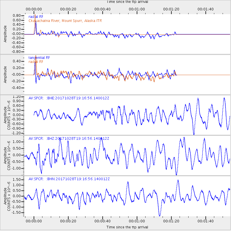
SPCR Ckakachatna River, Mount Spurr, Alaska - Earthquake Result Viewer
*The percent match for this event was below the threshold and hence no stack was calculated.
| Earthquake location: |
North Of Franz Josef Land |
| Earthquake latitude/longitude: |
86.9/55.1 |
| Earthquake time(UTC): |
2017/10/28 (301) 19:11:01 GMT |
| Earthquake Depth: |
10 km |
| Earthquake Magnitude: |
6.0 Mww |
| Earthquake Catalog/Contributor: |
NEIC PDE/us |
|
| Network: |
AV Alaska Volcano Observatory |
| Station: |
SPCR Ckakachatna River, Mount Spurr, Alaska |
| Lat/Lon: |
61.20 N/152.21 W |
| Elevation: |
984 m |
|
| Distance: |
31.8 deg |
| Az: |
24.989 deg |
| Baz: |
357.272 deg |
| Ray Param: |
$rayparam |
*The percent match for this event was below the threshold and hence was not used in the summary stack. |
|
| Radial Match: |
60.269337 % |
| Radial Bump: |
400 |
| Transverse Match: |
53.99422 % |
| Transverse Bump: |
400 |
| SOD ConfigId: |
13570011 |
| Insert Time: |
2019-04-29 00:53:32.754 +0000 |
| GWidth: |
2.5 |
| Max Bumps: |
400 |
| Tol: |
0.001 |
|
Signal To Noise
| Channel | StoN | STA | LTA |
| AV:SPCR: :BHZ:20171028T19:16:56.140012Z | 1.9146701 | 6.393051E-7 | 3.338983E-7 |
| AV:SPCR: :BHN:20171028T19:16:56.140012Z | 3.2460406 | 4.7206103E-7 | 1.4542671E-7 |
| AV:SPCR: :BHE:20171028T19:16:56.140012Z | 1.1051666 | 2.0990701E-7 | 1.8993246E-7 |
| Arrivals |
| Ps | |
| PpPs | |
| PsPs/PpSs | |


