You are here: Home > Network List > CI - Caltech Regional Seismic Network Stations List
> Station SMM Simmler, CA, USA > Earthquake Result Viewer
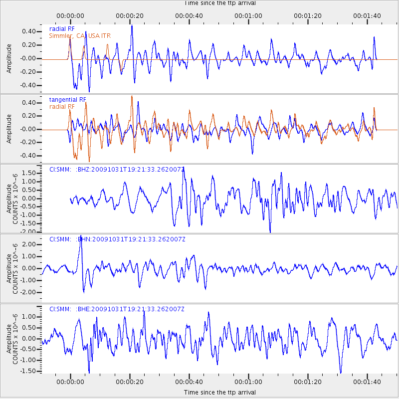
SMM Simmler, CA, USA - Earthquake Result Viewer
*The percent match for this event was below the threshold and hence no stack was calculated.
| Earthquake location: |
Santa Cruz Islands |
| Earthquake latitude/longitude: |
-11.4/166.4 |
| Earthquake time(UTC): |
2009/10/31 (304) 19:09:51 GMT |
| Earthquake Depth: |
134 km |
| Earthquake Magnitude: |
5.9 MB, 5.9 MW, 5.9 MW |
| Earthquake Catalog/Contributor: |
WHDF/NEIC |
|
| Network: |
CI Caltech Regional Seismic Network |
| Station: |
SMM Simmler, CA, USA |
| Lat/Lon: |
35.31 N/120.00 W |
| Elevation: |
599 m |
|
| Distance: |
83.5 deg |
| Az: |
52.161 deg |
| Baz: |
251.252 deg |
| Ray Param: |
$rayparam |
*The percent match for this event was below the threshold and hence was not used in the summary stack. |
|
| Radial Match: |
74.193886 % |
| Radial Bump: |
400 |
| Transverse Match: |
69.04047 % |
| Transverse Bump: |
400 |
| SOD ConfigId: |
2622 |
| Insert Time: |
2010-02-26 01:33:07.846 +0000 |
| GWidth: |
2.5 |
| Max Bumps: |
400 |
| Tol: |
0.001 |
|
Signal To Noise
| Channel | StoN | STA | LTA |
| CI:SMM: :BHN:20091031T19:21:33.262007Z | 4.938302 | 1.1298763E-6 | 2.2879856E-7 |
| CI:SMM: :BHE:20091031T19:21:33.262007Z | 2.0596616 | 5.4133676E-7 | 2.62828E-7 |
| CI:SMM: :BHZ:20091031T19:21:33.262007Z | 1.5608968 | 6.0985764E-7 | 3.9070977E-7 |
| Arrivals |
| Ps | |
| PpPs | |
| PsPs/PpSs | |


