You are here: Home > Network List > CI - Caltech Regional Seismic Network Stations List
> Station GLA Glamis, Glamis, CA, USA > Earthquake Result Viewer
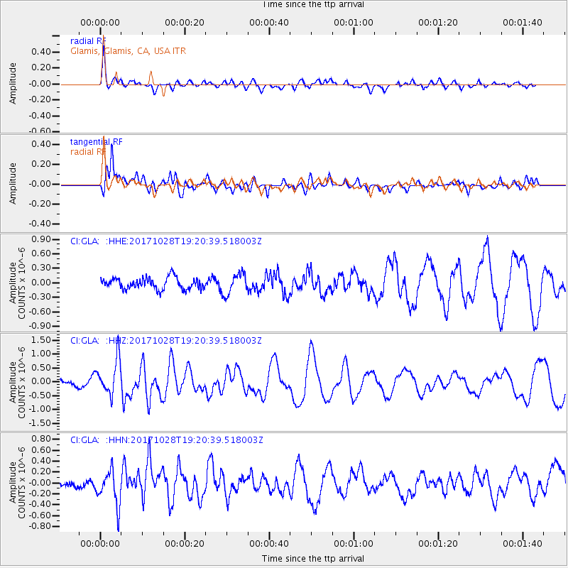
GLA Glamis, Glamis, CA, USA - Earthquake Result Viewer
*The percent match for this event was below the threshold and hence no stack was calculated.
| Earthquake location: |
North Of Franz Josef Land |
| Earthquake latitude/longitude: |
86.9/55.1 |
| Earthquake time(UTC): |
2017/10/28 (301) 19:11:01 GMT |
| Earthquake Depth: |
10 km |
| Earthquake Magnitude: |
6.0 Mww |
| Earthquake Catalog/Contributor: |
NEIC PDE/us |
|
| Network: |
CI Caltech Regional Seismic Network |
| Station: |
GLA Glamis, Glamis, CA, USA |
| Lat/Lon: |
33.05 N/114.83 W |
| Elevation: |
610 m |
|
| Distance: |
60.2 deg |
| Az: |
350.289 deg |
| Baz: |
0.628 deg |
| Ray Param: |
$rayparam |
*The percent match for this event was below the threshold and hence was not used in the summary stack. |
|
| Radial Match: |
68.06463 % |
| Radial Bump: |
400 |
| Transverse Match: |
68.87654 % |
| Transverse Bump: |
400 |
| SOD ConfigId: |
13570011 |
| Insert Time: |
2019-04-29 00:54:37.679 +0000 |
| GWidth: |
2.5 |
| Max Bumps: |
400 |
| Tol: |
0.001 |
|
Signal To Noise
| Channel | StoN | STA | LTA |
| CI:GLA: :HHZ:20171028T19:20:39.518003Z | 3.9769623 | 6.408472E-7 | 1.6113985E-7 |
| CI:GLA: :HHN:20171028T19:20:39.518003Z | 2.4264557 | 3.189335E-7 | 1.3144006E-7 |
| CI:GLA: :HHE:20171028T19:20:39.518003Z | 1.8314426 | 2.1879E-7 | 1.1946321E-7 |
| Arrivals |
| Ps | |
| PpPs | |
| PsPs/PpSs | |


