You are here: Home > Network List > CI - Caltech Regional Seismic Network Stations List
> Station MPP McPhearson Peak > Earthquake Result Viewer
MPP McPhearson Peak - Earthquake Result Viewer
*The percent match for this event was below the threshold and hence no stack was calculated.
| Earthquake location: |
North Of Franz Josef Land |
| Earthquake latitude/longitude: |
86.9/55.1 |
| Earthquake time(UTC): |
2017/10/28 (301) 19:11:01 GMT |
| Earthquake Depth: |
10 km |
| Earthquake Magnitude: |
6.0 Mww |
| Earthquake Catalog/Contributor: |
NEIC PDE/us |
|
| Network: |
CI Caltech Regional Seismic Network |
| Station: |
MPP McPhearson Peak |
| Lat/Lon: |
34.89 N/119.81 W |
| Elevation: |
1739 m |
|
| Distance: |
58.4 deg |
| Az: |
355.125 deg |
| Baz: |
0.323 deg |
| Ray Param: |
$rayparam |
*The percent match for this event was below the threshold and hence was not used in the summary stack. |
|
| Radial Match: |
64.860886 % |
| Radial Bump: |
400 |
| Transverse Match: |
69.488594 % |
| Transverse Bump: |
400 |
| SOD ConfigId: |
13570011 |
| Insert Time: |
2019-04-29 00:54:47.905 +0000 |
| GWidth: |
2.5 |
| Max Bumps: |
400 |
| Tol: |
0.001 |
|
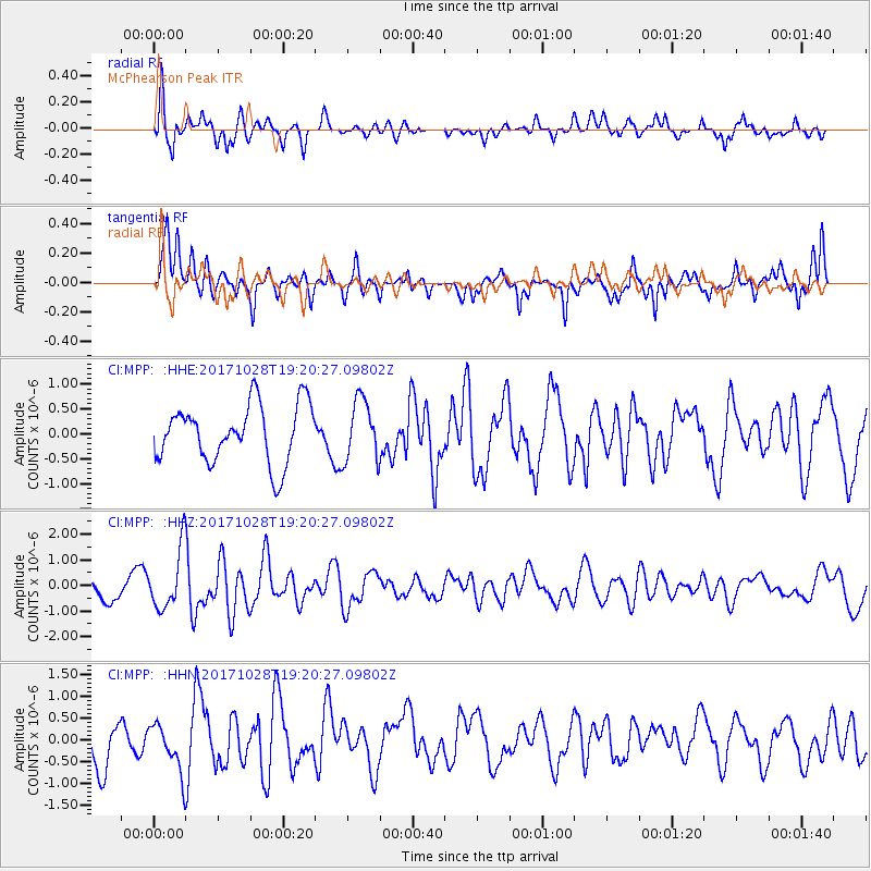
Signal To Noise
| Channel | StoN | STA | LTA |
| CI:MPP: :HHZ:20171028T19:20:27.09802Z | 2.4232895 | 1.2025611E-6 | 4.962515E-7 |
| CI:MPP: :HHN:20171028T19:20:27.09802Z | 1.0181818 | 5.717532E-7 | 5.6154335E-7 |
| CI:MPP: :HHE:20171028T19:20:27.09802Z | 1.0731522 | 6.263035E-7 | 5.836111E-7 |
| Arrivals |
| Ps | |
| PpPs | |
| PsPs/PpSs | |


