You are here: Home > Network List > CI - Caltech Regional Seismic Network Stations List
> Station SMM Simmler, CA, USA > Earthquake Result Viewer
SMM Simmler, CA, USA - Earthquake Result Viewer
*The percent match for this event was below the threshold and hence no stack was calculated.
| Earthquake location: |
North Of Franz Josef Land |
| Earthquake latitude/longitude: |
86.9/55.1 |
| Earthquake time(UTC): |
2017/10/28 (301) 19:11:01 GMT |
| Earthquake Depth: |
10 km |
| Earthquake Magnitude: |
6.0 Mww |
| Earthquake Catalog/Contributor: |
NEIC PDE/us |
|
| Network: |
CI Caltech Regional Seismic Network |
| Station: |
SMM Simmler, CA, USA |
| Lat/Lon: |
35.31 N/120.00 W |
| Elevation: |
599 m |
|
| Distance: |
58.0 deg |
| Az: |
355.304 deg |
| Baz: |
0.313 deg |
| Ray Param: |
$rayparam |
*The percent match for this event was below the threshold and hence was not used in the summary stack. |
|
| Radial Match: |
51.47091 % |
| Radial Bump: |
400 |
| Transverse Match: |
67.165596 % |
| Transverse Bump: |
400 |
| SOD ConfigId: |
13570011 |
| Insert Time: |
2019-04-29 00:54:58.240 +0000 |
| GWidth: |
2.5 |
| Max Bumps: |
400 |
| Tol: |
0.001 |
|
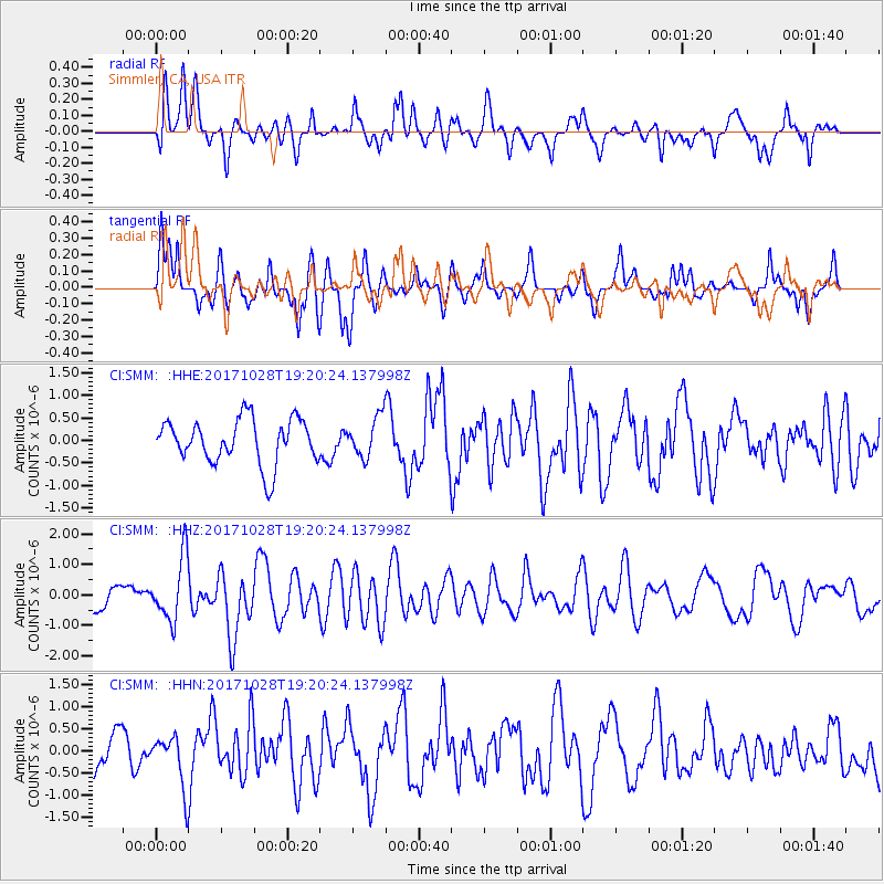
Signal To Noise
| Channel | StoN | STA | LTA |
| CI:SMM: :HHZ:20171028T19:20:24.137998Z | 2.6595066 | 1.0339365E-6 | 3.8877008E-7 |
| CI:SMM: :HHN:20171028T19:20:24.137998Z | 1.3108543 | 6.1181055E-7 | 4.667266E-7 |
| CI:SMM: :HHE:20171028T19:20:24.137998Z | 0.7285122 | 3.6178673E-7 | 4.9661037E-7 |
| Arrivals |
| Ps | |
| PpPs | |
| PsPs/PpSs | |


