S15A Panguitch, AZ, USA - Earthquake Result Viewer
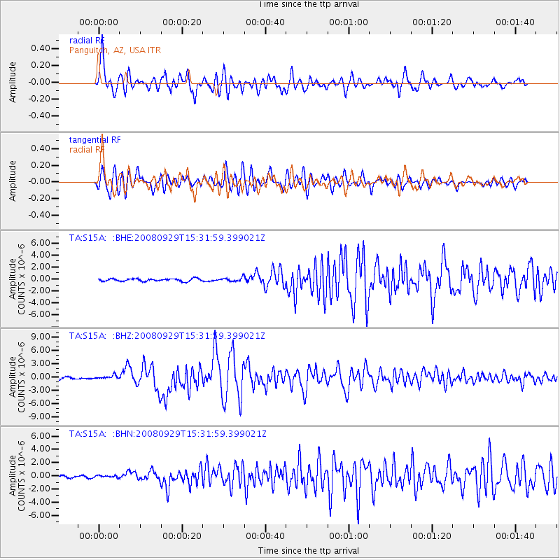
Earthquake location: Kermadec Islands, New Zealand
Earthquake latitude/longitude: -29.8/-177.7
Earthquake time(UTC): 2008/09/29 (273) 15:19:31 GMT
Earthquake Depth: 36 km
Earthquake Magnitude: 6.5 MB, 6.7 MS, 7.0 MW, 7.0 MW
Earthquake Catalog/Contributor: WHDF/NEIC
Network: TA USArray Transportable Network (new EarthScope stations)
Station: S15A Panguitch, AZ, USA
Lat/Lon: 37.68 N/112.36 W
Elevation: 2102 m
Distance: 90.7 deg
Az: 46.14 deg
Baz: 232.205 deg
Ray Param: 0.041649204
Estimated Moho Depth: 12.75 km
Estimated Crust Vp/Vs: 1.60
Assumed Crust Vp: 6.194 km/s
Estimated Crust Vs: 3.871 km/s
Estimated Crust Poisson's Ratio: 0.18
Radial Match: 85.041885 %
Radial Bump: 400
Transverse Match: 74.3816 %
Transverse Bump: 400
SOD ConfigId: 2560
Insert Time: 2010-03-06 05:31:34.300 +0000
GWidth: 2.5
Max Bumps: 400
Tol: 0.001

Signal To Noise

ChannelStoNSTALTA
TA:S15A: :BHZ:20080929T15:31:59.399021Z2.3988244.1925006E-71.7477316E-7
TA:S15A: :BHN:20080929T15:31:59.399021Z0.95929031.516148E-71.5804892E-7
TA:S15A: :BHE:20080929T15:31:59.399021Z1.46475863.1478476E-72.1490555E-7
Arrivals
Ps1.3 SECOND
PpPs5.2 SECOND
PsPs/PpSs6.5 SECOND