You are here: Home > Network List > CI - Caltech Regional Seismic Network Stations List
> Station SMM Simmler, CA, USA > Earthquake Result Viewer
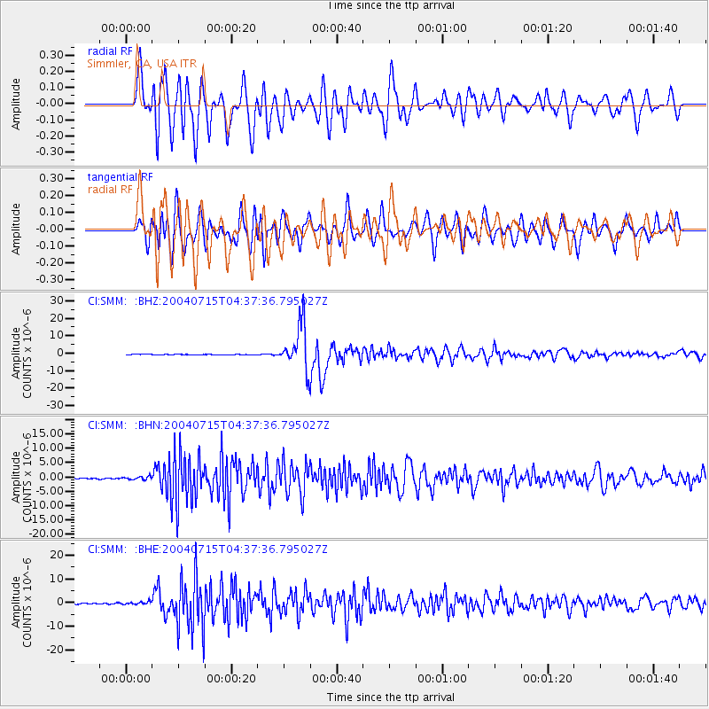
SMM Simmler, CA, USA - Earthquake Result Viewer
*The percent match for this event was below the threshold and hence no stack was calculated.
| Earthquake location: |
Fiji Islands Region |
| Earthquake latitude/longitude: |
-17.6/-178.6 |
| Earthquake time(UTC): |
2004/07/15 (197) 04:27:12 GMT |
| Earthquake Depth: |
560 km |
| Earthquake Magnitude: |
5.5 MB |
| Earthquake Catalog/Contributor: |
WHDF/NEIC |
|
| Network: |
CI Caltech Regional Seismic Network |
| Station: |
SMM Simmler, CA, USA |
| Lat/Lon: |
35.31 N/120.00 W |
| Elevation: |
599 m |
|
| Distance: |
76.5 deg |
| Az: |
45.884 deg |
| Baz: |
236.836 deg |
| Ray Param: |
$rayparam |
*The percent match for this event was below the threshold and hence was not used in the summary stack. |
|
| Radial Match: |
83.56597 % |
| Radial Bump: |
400 |
| Transverse Match: |
81.30214 % |
| Transverse Bump: |
400 |
| SOD ConfigId: |
2459 |
| Insert Time: |
2010-02-26 01:33:10.556 +0000 |
| GWidth: |
2.5 |
| Max Bumps: |
400 |
| Tol: |
0.001 |
|
Signal To Noise
| Channel | StoN | STA | LTA |
| CI:SMM: :BHN:20040715T04:37:36.795027Z | 3.2967489 | 5.4744334E-7 | 1.6605551E-7 |
| CI:SMM: :BHE:20040715T04:37:36.795027Z | 3.1771579 | 5.6746916E-7 | 1.7860906E-7 |
| CI:SMM: :BHZ:20040715T04:37:36.795027Z | 20.040976 | 2.6315524E-6 | 1.3130861E-7 |
| Arrivals |
| Ps | |
| PpPs | |
| PsPs/PpSs | |


