You are here: Home > Network List > LD - Lamont-Doherty Cooperative Seismographic Network Stations List
> Station LUPA Lehigh University, PA > Earthquake Result Viewer
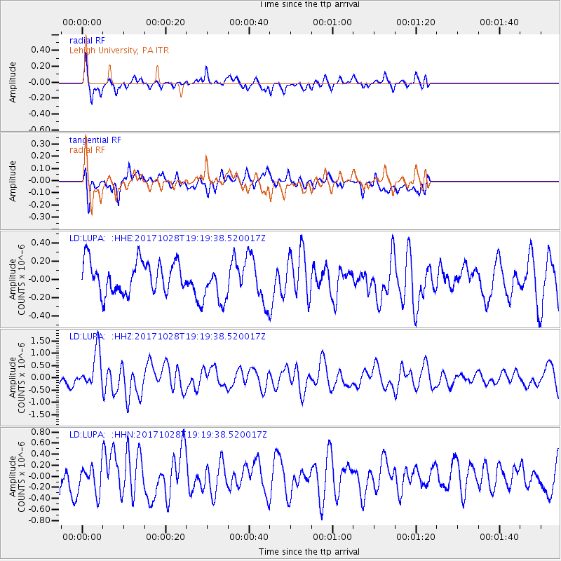
LUPA Lehigh University, PA - Earthquake Result Viewer
*The percent match for this event was below the threshold and hence no stack was calculated.
| Earthquake location: |
North Of Franz Josef Land |
| Earthquake latitude/longitude: |
86.9/55.1 |
| Earthquake time(UTC): |
2017/10/28 (301) 19:11:01 GMT |
| Earthquake Depth: |
10 km |
| Earthquake Magnitude: |
6.0 Mww |
| Earthquake Catalog/Contributor: |
NEIC PDE/us |
|
| Network: |
LD Lamont-Doherty Cooperative Seismographic Network |
| Station: |
LUPA Lehigh University, PA |
| Lat/Lon: |
40.60 N/75.37 W |
| Elevation: |
236 m |
|
| Distance: |
51.7 deg |
| Az: |
312.43 deg |
| Baz: |
3.032 deg |
| Ray Param: |
$rayparam |
*The percent match for this event was below the threshold and hence was not used in the summary stack. |
|
| Radial Match: |
70.88574 % |
| Radial Bump: |
380 |
| Transverse Match: |
58.030823 % |
| Transverse Bump: |
400 |
| SOD ConfigId: |
13570011 |
| Insert Time: |
2019-04-29 00:57:41.997 +0000 |
| GWidth: |
2.5 |
| Max Bumps: |
400 |
| Tol: |
0.001 |
|
Signal To Noise
| Channel | StoN | STA | LTA |
| LD:LUPA: :HHZ:20171028T19:19:38.520017Z | 3.9494045 | 7.641293E-7 | 1.9347962E-7 |
| LD:LUPA: :HHN:20171028T19:19:38.520017Z | 1.2909293 | 2.468163E-7 | 1.9119275E-7 |
| LD:LUPA: :HHE:20171028T19:19:38.520017Z | 1.3545486 | 2.3310012E-7 | 1.7208694E-7 |
| Arrivals |
| Ps | |
| PpPs | |
| PsPs/PpSs | |


