You are here: Home > Network List > CI - Caltech Regional Seismic Network Stations List
> Station SMM Simmler, CA, USA > Earthquake Result Viewer
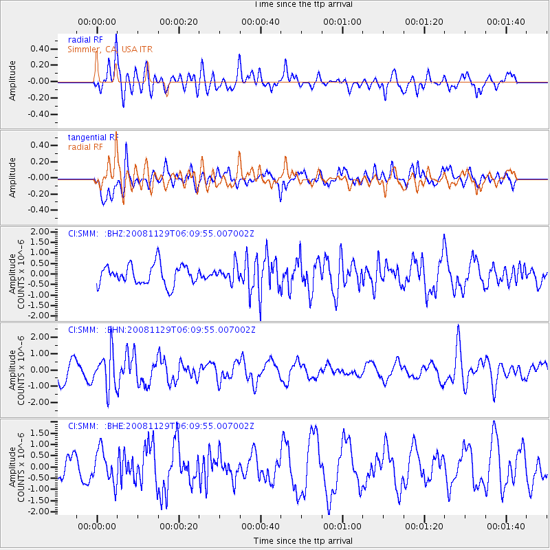
SMM Simmler, CA, USA - Earthquake Result Viewer
*The percent match for this event was below the threshold and hence no stack was calculated.
| Earthquake location: |
Fiji Islands Region |
| Earthquake latitude/longitude: |
-18.7/-177.7 |
| Earthquake time(UTC): |
2008/11/29 (334) 05:59:16 GMT |
| Earthquake Depth: |
386 km |
| Earthquake Magnitude: |
5.7 MB, 6.0 MW, 5.9 MW |
| Earthquake Catalog/Contributor: |
WHDF/NEIC |
|
| Network: |
CI Caltech Regional Seismic Network |
| Station: |
SMM Simmler, CA, USA |
| Lat/Lon: |
35.31 N/120.00 W |
| Elevation: |
599 m |
|
| Distance: |
76.7 deg |
| Az: |
45.282 deg |
| Baz: |
235.442 deg |
| Ray Param: |
$rayparam |
*The percent match for this event was below the threshold and hence was not used in the summary stack. |
|
| Radial Match: |
69.45153 % |
| Radial Bump: |
400 |
| Transverse Match: |
44.679367 % |
| Transverse Bump: |
400 |
| SOD ConfigId: |
2658 |
| Insert Time: |
2010-02-26 01:33:13.749 +0000 |
| GWidth: |
2.5 |
| Max Bumps: |
400 |
| Tol: |
0.001 |
|
Signal To Noise
| Channel | StoN | STA | LTA |
| CI:SMM: :BHN:20081129T06:09:55.007002Z | 2.600953 | 1.1457497E-6 | 4.4051149E-7 |
| CI:SMM: :BHE:20081129T06:09:55.007002Z | 1.2914927 | 7.417689E-7 | 5.7435005E-7 |
| CI:SMM: :BHZ:20081129T06:09:55.007002Z | 0.8251388 | 3.88034E-7 | 4.7026512E-7 |
| Arrivals |
| Ps | |
| PpPs | |
| PsPs/PpSs | |


