You are here: Home > Network List > TA - USArray Transportable Network (new EarthScope stations) Stations List
> Station S15A Panguitch, AZ, USA > Earthquake Result Viewer
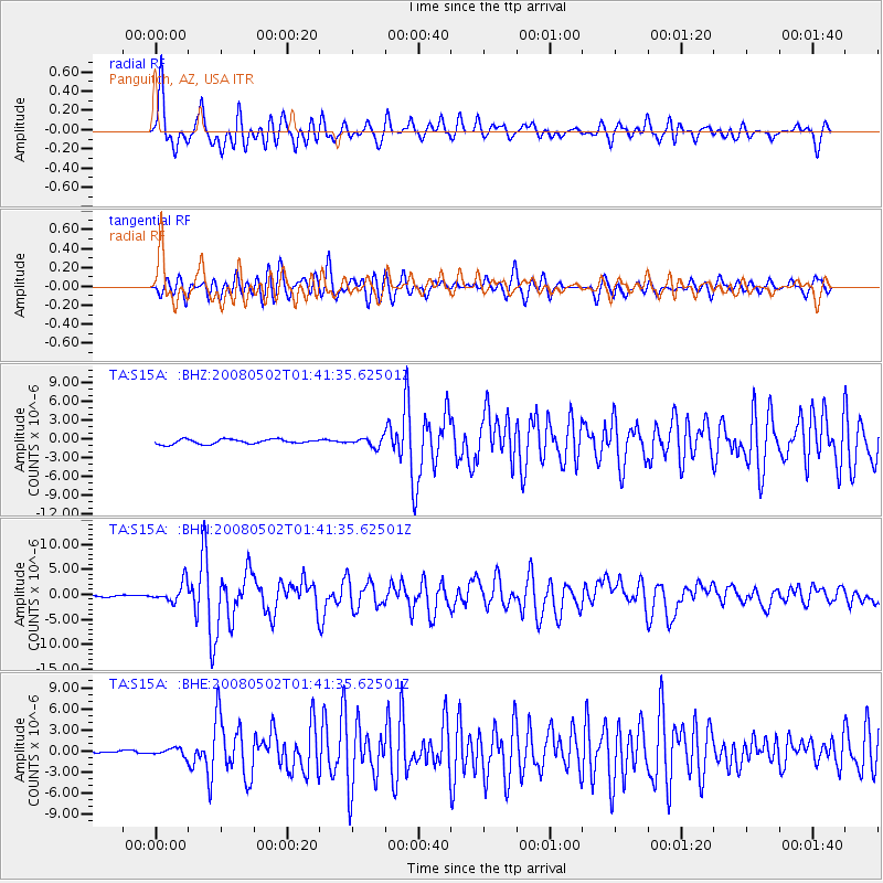
S15A Panguitch, AZ, USA - Earthquake Result Viewer
*The percent match for this event was below the threshold and hence no stack was calculated.
| Earthquake location: |
Andreanof Islands, Aleutian Is. |
| Earthquake latitude/longitude: |
51.9/-177.5 |
| Earthquake time(UTC): |
2008/05/02 (123) 01:33:37 GMT |
| Earthquake Depth: |
14 km |
| Earthquake Magnitude: |
6.3 MB, 6.8 MS, 6.6 MW, 6.6 MW |
| Earthquake Catalog/Contributor: |
WHDF/NEIC |
|
| Network: |
TA USArray Transportable Network (new EarthScope stations) |
| Station: |
S15A Panguitch, AZ, USA |
| Lat/Lon: |
37.68 N/112.36 W |
| Elevation: |
2102 m |
|
| Distance: |
46.8 deg |
| Az: |
80.852 deg |
| Baz: |
309.505 deg |
| Ray Param: |
$rayparam |
*The percent match for this event was below the threshold and hence was not used in the summary stack. |
|
| Radial Match: |
76.54014 % |
| Radial Bump: |
400 |
| Transverse Match: |
70.649216 % |
| Transverse Bump: |
400 |
| SOD ConfigId: |
2504 |
| Insert Time: |
2010-03-06 05:33:00.014 +0000 |
| GWidth: |
2.5 |
| Max Bumps: |
400 |
| Tol: |
0.001 |
|
Signal To Noise
| Channel | StoN | STA | LTA |
| TA:S15A: :BHN:20080502T01:41:35.62501Z | 11.150371 | 1.959528E-6 | 1.7573659E-7 |
| TA:S15A: :BHE:20080502T01:41:35.62501Z | 1.41845 | 5.373021E-7 | 3.7879525E-7 |
| TA:S15A: :BHZ:20080502T01:41:35.62501Z | 1.8732228 | 7.013699E-7 | 3.7441885E-7 |
| Arrivals |
| Ps | |
| PpPs | |
| PsPs/PpSs | |


