You are here: Home > Network List > TA - USArray Transportable Network (new EarthScope stations) Stations List
> Station S15A Panguitch, AZ, USA > Earthquake Result Viewer
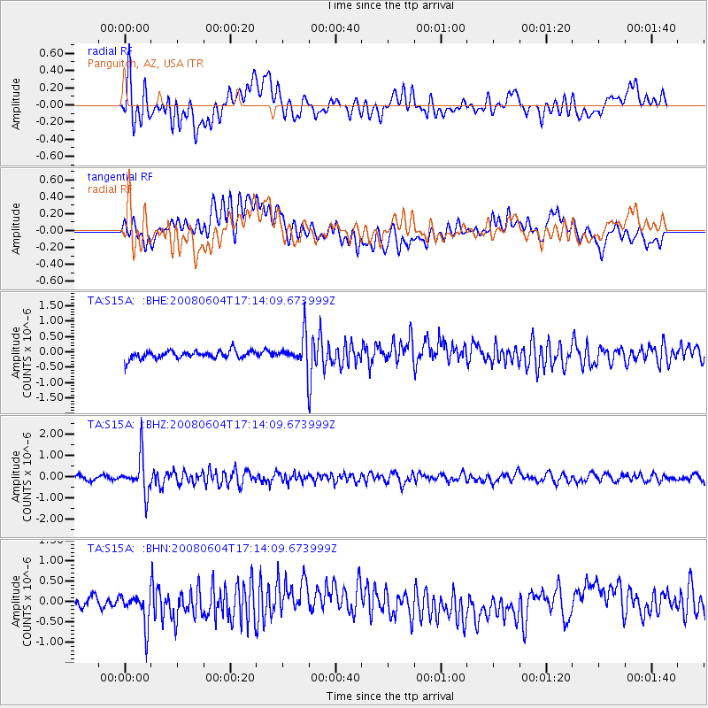
S15A Panguitch, AZ, USA - Earthquake Result Viewer
*The percent match for this event was below the threshold and hence no stack was calculated.
| Earthquake location: |
Hokkaido, Japan Region |
| Earthquake latitude/longitude: |
41.5/139.0 |
| Earthquake time(UTC): |
2008/06/04 (156) 17:03:07 GMT |
| Earthquake Depth: |
213 km |
| Earthquake Magnitude: |
5.5 MB, 5.7 MW, 5.7 MW |
| Earthquake Catalog/Contributor: |
WHDF/NEIC |
|
| Network: |
TA USArray Transportable Network (new EarthScope stations) |
| Station: |
S15A Panguitch, AZ, USA |
| Lat/Lon: |
37.68 N/112.36 W |
| Elevation: |
2102 m |
|
| Distance: |
77.8 deg |
| Az: |
50.316 deg |
| Baz: |
313.267 deg |
| Ray Param: |
$rayparam |
*The percent match for this event was below the threshold and hence was not used in the summary stack. |
|
| Radial Match: |
67.46763 % |
| Radial Bump: |
400 |
| Transverse Match: |
56.368027 % |
| Transverse Bump: |
400 |
| SOD ConfigId: |
2504 |
| Insert Time: |
2010-03-06 05:33:17.519 +0000 |
| GWidth: |
2.5 |
| Max Bumps: |
400 |
| Tol: |
0.001 |
|
Signal To Noise
| Channel | StoN | STA | LTA |
| TA:S15A: :BHZ:20080604T17:14:09.673999Z | 7.23382 | 8.4694204E-7 | 1.1708089E-7 |
| TA:S15A: :BHN:20080604T17:14:09.673999Z | 2.4399412 | 3.9023757E-7 | 1.5993729E-7 |
| TA:S15A: :BHE:20080604T17:14:09.673999Z | 3.8945484 | 5.057417E-7 | 1.2985889E-7 |
| Arrivals |
| Ps | |
| PpPs | |
| PsPs/PpSs | |


