You are here: Home > Network List > TA - USArray Transportable Network (new EarthScope stations) Stations List
> Station S15A Panguitch, AZ, USA > Earthquake Result Viewer
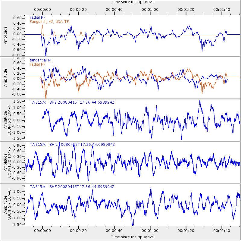
S15A Panguitch, AZ, USA - Earthquake Result Viewer
*The percent match for this event was below the threshold and hence no stack was calculated.
| Earthquake location: |
Tonga Islands |
| Earthquake latitude/longitude: |
-18.7/-176.0 |
| Earthquake time(UTC): |
2008/04/15 (106) 17:24:56 GMT |
| Earthquake Depth: |
10 km |
| Earthquake Magnitude: |
5.5 MB, 5.5 MS, 5.7 MW, 5.6 MW |
| Earthquake Catalog/Contributor: |
WHDF/NEIC |
|
| Network: |
TA USArray Transportable Network (new EarthScope stations) |
| Station: |
S15A Panguitch, AZ, USA |
| Lat/Lon: |
37.68 N/112.36 W |
| Elevation: |
2102 m |
|
| Distance: |
81.9 deg |
| Az: |
45.874 deg |
| Baz: |
239.038 deg |
| Ray Param: |
$rayparam |
*The percent match for this event was below the threshold and hence was not used in the summary stack. |
|
| Radial Match: |
50.394825 % |
| Radial Bump: |
400 |
| Transverse Match: |
54.959213 % |
| Transverse Bump: |
400 |
| SOD ConfigId: |
2504 |
| Insert Time: |
2010-03-06 05:33:32.210 +0000 |
| GWidth: |
2.5 |
| Max Bumps: |
400 |
| Tol: |
0.001 |
|
Signal To Noise
| Channel | StoN | STA | LTA |
| TA:S15A: :BHN:20080415T17:36:44.698994Z | 1.11955 | 3.1231758E-7 | 2.7896706E-7 |
| TA:S15A: :BHE:20080415T17:36:44.698994Z | 1.019657 | 6.123917E-7 | 6.0058596E-7 |
| TA:S15A: :BHZ:20080415T17:36:44.698994Z | 0.7272011 | 4.032376E-7 | 5.5450636E-7 |
| Arrivals |
| Ps | |
| PpPs | |
| PsPs/PpSs | |


