You are here: Home > Network List > TA - USArray Transportable Network (new EarthScope stations) Stations List
> Station 121A Cookes Peak, Deming, NM, USA > Earthquake Result Viewer
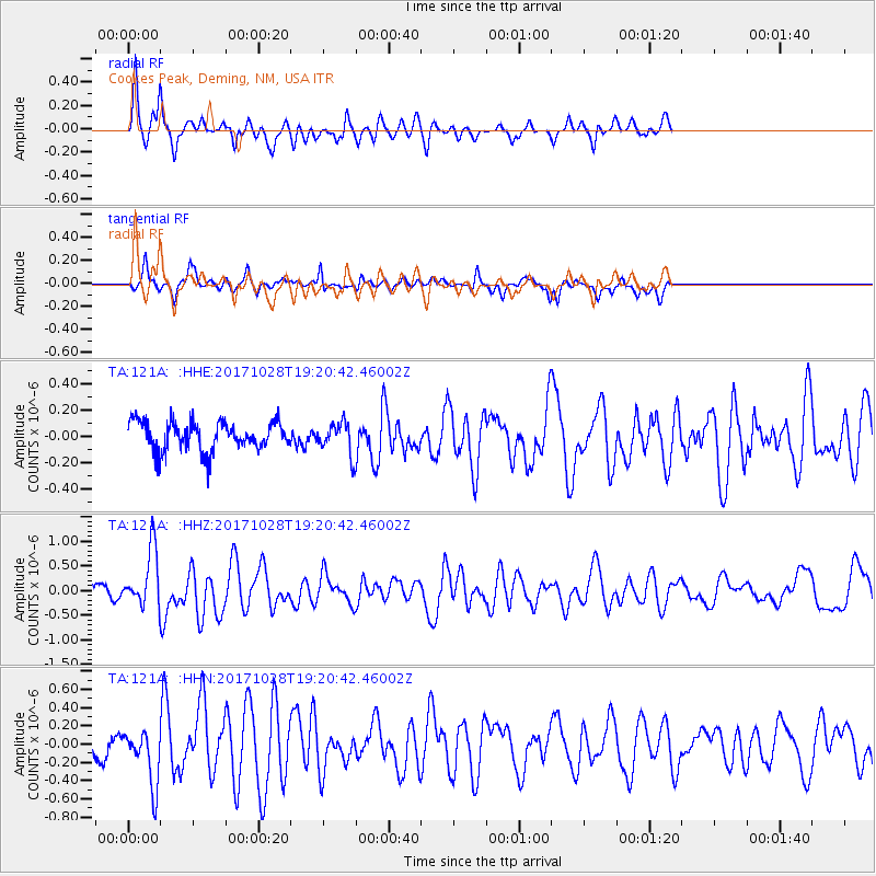
121A Cookes Peak, Deming, NM, USA - Earthquake Result Viewer
*The percent match for this event was below the threshold and hence no stack was calculated.
| Earthquake location: |
North Of Franz Josef Land |
| Earthquake latitude/longitude: |
86.9/55.1 |
| Earthquake time(UTC): |
2017/10/28 (301) 19:11:01 GMT |
| Earthquake Depth: |
10 km |
| Earthquake Magnitude: |
6.0 Mww |
| Earthquake Catalog/Contributor: |
NEIC PDE/us |
|
| Network: |
TA USArray Transportable Network (new EarthScope stations) |
| Station: |
121A Cookes Peak, Deming, NM, USA |
| Lat/Lon: |
32.53 N/107.79 W |
| Elevation: |
1652 m |
|
| Distance: |
60.6 deg |
| Az: |
343.461 deg |
| Baz: |
1.054 deg |
| Ray Param: |
$rayparam |
*The percent match for this event was below the threshold and hence was not used in the summary stack. |
|
| Radial Match: |
80.510864 % |
| Radial Bump: |
400 |
| Transverse Match: |
75.209435 % |
| Transverse Bump: |
334 |
| SOD ConfigId: |
13570011 |
| Insert Time: |
2019-04-29 01:02:03.344 +0000 |
| GWidth: |
2.5 |
| Max Bumps: |
400 |
| Tol: |
0.001 |
|
Signal To Noise
| Channel | StoN | STA | LTA |
| TA:121A: :HHZ:20171028T19:20:42.46002Z | 5.679982 | 5.879859E-7 | 1.03518964E-7 |
| TA:121A: :HHN:20171028T19:20:42.46002Z | 1.7924584 | 2.99898E-7 | 1.67311E-7 |
| TA:121A: :HHE:20171028T19:20:42.46002Z | 0.67362267 | 7.4705376E-8 | 1.1090093E-7 |
| Arrivals |
| Ps | |
| PpPs | |
| PsPs/PpSs | |


