You are here: Home > Network List > TA - USArray Transportable Network (new EarthScope stations) Stations List
> Station 833A Chaparral WMA, Artesia Wells, TX, USA > Earthquake Result Viewer
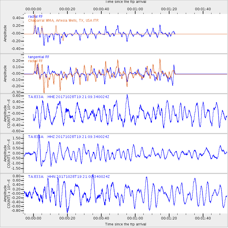
833A Chaparral WMA, Artesia Wells, TX, USA - Earthquake Result Viewer
*The percent match for this event was below the threshold and hence no stack was calculated.
| Earthquake location: |
North Of Franz Josef Land |
| Earthquake latitude/longitude: |
86.9/55.1 |
| Earthquake time(UTC): |
2017/10/28 (301) 19:11:01 GMT |
| Earthquake Depth: |
10 km |
| Earthquake Magnitude: |
6.0 Mww |
| Earthquake Catalog/Contributor: |
NEIC PDE/us |
|
| Network: |
TA USArray Transportable Network (new EarthScope stations) |
| Station: |
833A Chaparral WMA, Artesia Wells, TX, USA |
| Lat/Lon: |
28.32 N/99.39 W |
| Elevation: |
171 m |
|
| Distance: |
64.7 deg |
| Az: |
335.198 deg |
| Baz: |
1.488 deg |
| Ray Param: |
$rayparam |
*The percent match for this event was below the threshold and hence was not used in the summary stack. |
|
| Radial Match: |
67.90871 % |
| Radial Bump: |
236 |
| Transverse Match: |
55.335377 % |
| Transverse Bump: |
390 |
| SOD ConfigId: |
13570011 |
| Insert Time: |
2019-04-29 01:02:03.838 +0000 |
| GWidth: |
2.5 |
| Max Bumps: |
400 |
| Tol: |
0.001 |
|
Signal To Noise
| Channel | StoN | STA | LTA |
| TA:833A: :HHZ:20171028T19:21:09.340024Z | 4.2345543 | 8.033901E-7 | 1.8972247E-7 |
| TA:833A: :HHN:20171028T19:21:09.340024Z | 1.2336836 | 1.7300296E-7 | 1.4023284E-7 |
| TA:833A: :HHE:20171028T19:21:09.340024Z | 0.6651782 | 1.4802039E-7 | 2.2252742E-7 |
| Arrivals |
| Ps | |
| PpPs | |
| PsPs/PpSs | |


