You are here: Home > Network List > CI - Caltech Regional Seismic Network Stations List
> Station SMM Simmler, CA, USA > Earthquake Result Viewer
SMM Simmler, CA, USA - Earthquake Result Viewer
*The percent match for this event was below the threshold and hence no stack was calculated.
| Earthquake location: |
Honduras |
| Earthquake latitude/longitude: |
15.8/-86.9 |
| Earthquake time(UTC): |
2009/06/08 (159) 05:13:14 GMT |
| Earthquake Depth: |
10 km |
| Earthquake Magnitude: |
5.5 MB, 4.9 MS, 5.4 MW, 5.4 MW |
| Earthquake Catalog/Contributor: |
WHDF/NEIC |
|
| Network: |
CI Caltech Regional Seismic Network |
| Station: |
SMM Simmler, CA, USA |
| Lat/Lon: |
35.31 N/120.00 W |
| Elevation: |
599 m |
|
| Distance: |
35.4 deg |
| Az: |
309.526 deg |
| Baz: |
114.768 deg |
| Ray Param: |
$rayparam |
*The percent match for this event was below the threshold and hence was not used in the summary stack. |
|
| Radial Match: |
70.23316 % |
| Radial Bump: |
400 |
| Transverse Match: |
69.42206 % |
| Transverse Bump: |
400 |
| SOD ConfigId: |
2648 |
| Insert Time: |
2010-02-26 01:33:18.123 +0000 |
| GWidth: |
2.5 |
| Max Bumps: |
400 |
| Tol: |
0.001 |
|
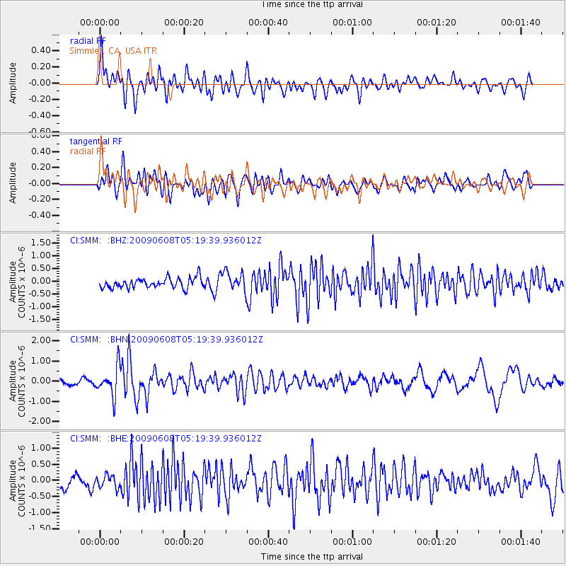
Signal To Noise
| Channel | StoN | STA | LTA |
| CI:SMM: :BHN:20090608T05:19:39.936012Z | 5.7556314 | 7.4802807E-7 | 1.2996456E-7 |
| CI:SMM: :BHE:20090608T05:19:39.936012Z | 1.0470428 | 2.0416245E-7 | 1.9498958E-7 |
| CI:SMM: :BHZ:20090608T05:19:39.936012Z | 1.933727 | 3.7489582E-7 | 1.9387214E-7 |
| Arrivals |
| Ps | |
| PpPs | |
| PsPs/PpSs | |


