You are here: Home > Network List > TA - USArray Transportable Network (new EarthScope stations) Stations List
> Station U33K Whale Pass, AK, USA > Earthquake Result Viewer
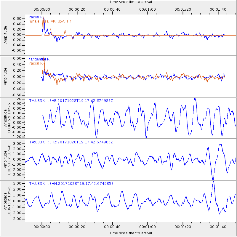
U33K Whale Pass, AK, USA - Earthquake Result Viewer
*The percent match for this event was below the threshold and hence no stack was calculated.
| Earthquake location: |
North Of Franz Josef Land |
| Earthquake latitude/longitude: |
86.9/55.1 |
| Earthquake time(UTC): |
2017/10/28 (301) 19:11:01 GMT |
| Earthquake Depth: |
10 km |
| Earthquake Magnitude: |
6.0 Mww |
| Earthquake Catalog/Contributor: |
NEIC PDE/us |
|
| Network: |
TA USArray Transportable Network (new EarthScope stations) |
| Station: |
U33K Whale Pass, AK, USA |
| Lat/Lon: |
56.11 N/133.12 W |
| Elevation: |
11 m |
|
| Distance: |
37.2 deg |
| Az: |
7.651 deg |
| Baz: |
359.257 deg |
| Ray Param: |
$rayparam |
*The percent match for this event was below the threshold and hence was not used in the summary stack. |
|
| Radial Match: |
58.18886 % |
| Radial Bump: |
324 |
| Transverse Match: |
53.390446 % |
| Transverse Bump: |
400 |
| SOD ConfigId: |
13570011 |
| Insert Time: |
2019-04-29 01:03:08.448 +0000 |
| GWidth: |
2.5 |
| Max Bumps: |
400 |
| Tol: |
0.001 |
|
Signal To Noise
| Channel | StoN | STA | LTA |
| TA:U33K: :BHZ:20171028T19:17:42.674985Z | 1.0125482 | 6.219685E-7 | 6.1426067E-7 |
| TA:U33K: :BHN:20171028T19:17:42.674985Z | 1.2898179 | 5.657782E-7 | 4.3864964E-7 |
| TA:U33K: :BHE:20171028T19:17:42.674985Z | 1.915714 | 7.4229877E-7 | 3.874789E-7 |
| Arrivals |
| Ps | |
| PpPs | |
| PsPs/PpSs | |


