You are here: Home > Network List > UW - Pacific Northwest Regional Seismic Network Stations List
> Station FISH Seaside, OR, USA > Earthquake Result Viewer
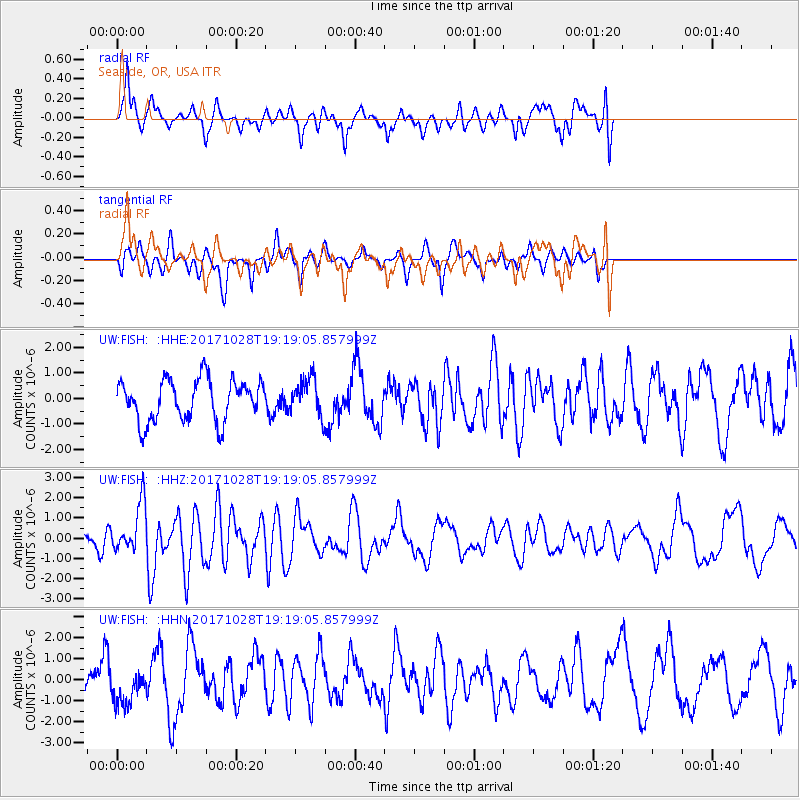
FISH Seaside, OR, USA - Earthquake Result Viewer
*The percent match for this event was below the threshold and hence no stack was calculated.
| Earthquake location: |
North Of Franz Josef Land |
| Earthquake latitude/longitude: |
86.9/55.1 |
| Earthquake time(UTC): |
2017/10/28 (301) 19:11:01 GMT |
| Earthquake Depth: |
10 km |
| Earthquake Magnitude: |
6.0 Mww |
| Earthquake Catalog/Contributor: |
NEIC PDE/us |
|
| Network: |
UW Pacific Northwest Regional Seismic Network |
| Station: |
FISH Seaside, OR, USA |
| Lat/Lon: |
45.93 N/123.56 W |
| Elevation: |
325 m |
|
| Distance: |
47.4 deg |
| Az: |
358.761 deg |
| Baz: |
0.097 deg |
| Ray Param: |
$rayparam |
*The percent match for this event was below the threshold and hence was not used in the summary stack. |
|
| Radial Match: |
81.10575 % |
| Radial Bump: |
400 |
| Transverse Match: |
56.837193 % |
| Transverse Bump: |
322 |
| SOD ConfigId: |
13570011 |
| Insert Time: |
2019-04-29 01:04:01.949 +0000 |
| GWidth: |
2.5 |
| Max Bumps: |
400 |
| Tol: |
0.001 |
|
Signal To Noise
| Channel | StoN | STA | LTA |
| UW:FISH: :HHZ:20171028T19:19:05.857999Z | 1.9262946 | 1.216087E-6 | 6.313089E-7 |
| UW:FISH: :HHN:20171028T19:19:05.857999Z | 1.0653969 | 8.763898E-7 | 8.2259464E-7 |
| UW:FISH: :HHE:20171028T19:19:05.857999Z | 0.81177354 | 6.5539905E-7 | 8.0736686E-7 |
| Arrivals |
| Ps | |
| PpPs | |
| PsPs/PpSs | |


