You are here: Home > Network List > UW - Pacific Northwest Regional Seismic Network Stations List
> Station GNW Green Mountain (BB) > Earthquake Result Viewer
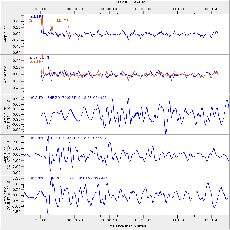
GNW Green Mountain (BB) - Earthquake Result Viewer
*The percent match for this event was below the threshold and hence no stack was calculated.
| Earthquake location: |
North Of Franz Josef Land |
| Earthquake latitude/longitude: |
86.9/55.1 |
| Earthquake time(UTC): |
2017/10/28 (301) 19:11:01 GMT |
| Earthquake Depth: |
10 km |
| Earthquake Magnitude: |
6.0 Mww |
| Earthquake Catalog/Contributor: |
NEIC PDE/us |
|
| Network: |
UW Pacific Northwest Regional Seismic Network |
| Station: |
GNW Green Mountain (BB) |
| Lat/Lon: |
47.56 N/122.83 W |
| Elevation: |
160 m |
|
| Distance: |
45.8 deg |
| Az: |
358.072 deg |
| Baz: |
0.155 deg |
| Ray Param: |
$rayparam |
*The percent match for this event was below the threshold and hence was not used in the summary stack. |
|
| Radial Match: |
59.907154 % |
| Radial Bump: |
316 |
| Transverse Match: |
71.12115 % |
| Transverse Bump: |
378 |
| SOD ConfigId: |
13570011 |
| Insert Time: |
2019-04-29 01:04:05.311 +0000 |
| GWidth: |
2.5 |
| Max Bumps: |
400 |
| Tol: |
0.001 |
|
Signal To Noise
| Channel | StoN | STA | LTA |
| UW:GNW: :BHZ:20171028T19:18:53.05499Z | 5.250958 | 1.2430631E-6 | 2.3673074E-7 |
| UW:GNW: :BHN:20171028T19:18:53.05499Z | 2.0068467 | 7.555109E-7 | 3.7646666E-7 |
| UW:GNW: :BHE:20171028T19:18:53.05499Z | 1.4915383 | 3.4208517E-7 | 2.2935058E-7 |
| Arrivals |
| Ps | |
| PpPs | |
| PsPs/PpSs | |


