You are here: Home > Network List > UW - Pacific Northwest Regional Seismic Network Stations List
> Station IZEE Izee, OR, USA > Earthquake Result Viewer
IZEE Izee, OR, USA - Earthquake Result Viewer
*The percent match for this event was below the threshold and hence no stack was calculated.
| Earthquake location: |
North Of Franz Josef Land |
| Earthquake latitude/longitude: |
86.9/55.1 |
| Earthquake time(UTC): |
2017/10/28 (301) 19:11:01 GMT |
| Earthquake Depth: |
10 km |
| Earthquake Magnitude: |
6.0 Mww |
| Earthquake Catalog/Contributor: |
NEIC PDE/us |
|
| Network: |
UW Pacific Northwest Regional Seismic Network |
| Station: |
IZEE Izee, OR, USA |
| Lat/Lon: |
44.08 N/119.50 W |
| Elevation: |
1293 m |
|
| Distance: |
49.2 deg |
| Az: |
354.899 deg |
| Baz: |
0.386 deg |
| Ray Param: |
$rayparam |
*The percent match for this event was below the threshold and hence was not used in the summary stack. |
|
| Radial Match: |
85.18982 % |
| Radial Bump: |
269 |
| Transverse Match: |
77.757706 % |
| Transverse Bump: |
240 |
| SOD ConfigId: |
13570011 |
| Insert Time: |
2019-04-29 01:04:05.840 +0000 |
| GWidth: |
2.5 |
| Max Bumps: |
400 |
| Tol: |
0.001 |
|
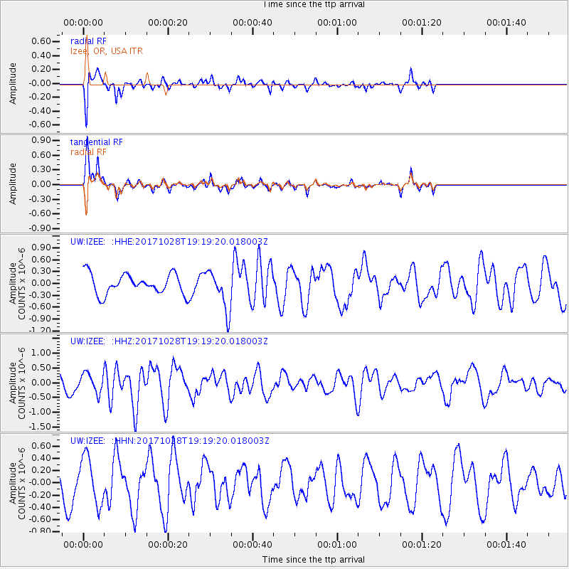
Signal To Noise
| Channel | StoN | STA | LTA |
| UW:IZEE: :HHZ:20171028T19:19:20.018003Z | 1.2617236 | 3.3478233E-7 | 2.6533726E-7 |
| UW:IZEE: :HHN:20171028T19:19:20.018003Z | 1.6614333 | 3.924478E-7 | 2.3621038E-7 |
| UW:IZEE: :HHE:20171028T19:19:20.018003Z | 1.4928871 | 3.6063963E-7 | 2.4157194E-7 |
| Arrivals |
| Ps | |
| PpPs | |
| PsPs/PpSs | |


